
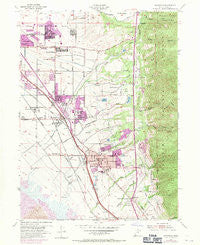
~ Kaysville UT topo map, 1:24000 scale, 7.5 X 7.5 Minute, Historical, 1955, updated 1971
Kaysville, Utah, USGS topographic map dated 1955.
Includes geographic coordinates (latitude and longitude). This topographic map is suitable for hiking, camping, and exploring, or framing it as a wall map.
Printed on-demand using high resolution imagery, on heavy weight and acid free paper, or alternatively on a variety of synthetic materials.
Topos available on paper, Waterproof, Poly, or Tyvek. Usually shipping rolled, unless combined with other folded maps in one order.
- Product Number: USGS-5458371
- Free digital map download (high-resolution, GeoPDF): Kaysville, Utah (file size: 13 MB)
- Map Size: please refer to the dimensions of the GeoPDF map above
- Weight (paper map): ca. 55 grams
- Map Type: POD USGS Topographic Map
- Map Series: HTMC
- Map Verison: Historical
- Cell ID: 23103
- Scan ID: 250118
- Imprint Year: 1971
- Woodland Tint: Yes
- Photo Revision Year: 1969
- Aerial Photo Year: 1969
- Field Check Year: 1955
- Datum: NAD27
- Map Projection: Polyconic
- Map published by United States Geological Survey
- Map published by United States Army Corps of Engineers
- Map published by United States Army
- Map Language: English
- Scanner Resolution: 600 dpi
- Map Cell Name: Kaysville
- Grid size: 7.5 X 7.5 Minute
- Date on map: 1955
- Map Scale: 1:24000
- Geographical region: Utah, United States
Neighboring Maps:
All neighboring USGS topo maps are available for sale online at a variety of scales.
Spatial coverage:
Topo map Kaysville, Utah, covers the geographical area associated the following places:
- Barton Manor Two - Meadow Hollow Condominium - Millcreek Estates - Heather Hills - Holmes Creek Estates - Cherry View - LaDonna Mesa - Walker - Avion Vista - Oakridge Terrace - Green Lawns - Hodson Estates - Meadows at Mutton Hollow Condominium - Cameron Estates - Village Green - Homeplace - Oak Forest Two - East Crest Estates - Vantage Park - Heath - Wasatch Heights - Island View Acres - Whitesides Estates - Cherry Lane Heights - Kays Creek - Rogers Park - Cook - North Hills Estates - Sundowner Condominium - Canyon Cove Estates - The Oaks at Mutton Hollow - Mutton Hollow Meadows - Creek View Estates - Fort Lane Plaza Condominium - Oak Hollow - Oakridge Farms - Hidden Hollow - Pilly Green - Happy Home Five - Brook Haven - Summer Haze - Morgan Farms - Kent Estates - Mountain Terrace Estates - Riley - Cresthomes Addition - Layton - Somerset Place Condominium - Eastridge Estates - Farmington Orchards - Dreams End - Wheat Ridge - Deer Run Estates - Aura Acres - Sommerset Hollow - Haven Park - Koziar Hills - Mala - Parkdale - Green Mountain Estates - The Meadows - Robins Park One and Two - Abrams Way - Kens - Chantilly Square - Property Consultants Condominium - Tri Oaks - East Oaks - Sahara Village - Church Street - Cottonwood - Roueche Hills - Dimond Oaks - Church Hill Estates - Clover Estates - Carrie Heights - Vallee Villa - Marketboro - Lakeview Mobile Home Park - Quail Creek - Natural Estates - Barnes Estates - Upland - Eastwood Estates - Country Oaks Condominium - Heatherglen - Fairfield Condominium - Country Meadows - Meadowbrook Hollow - Fort Lane - Robins Park - Kaysville - Somerset Farm - Tiffany Park - Layton Meadows Condominium - Oakridge Village - Mount Air Estates - Victorian Oaks - Hill Villa - Hidden Hideaway Condominium
- Map Area ID: AREA41.12541-112-111.875
- Northwest corner Lat/Long code: USGSNW41.125-112
- Northeast corner Lat/Long code: USGSNE41.125-111.875
- Southwest corner Lat/Long code: USGSSW41-112
- Southeast corner Lat/Long code: USGSSE41-111.875
- Northern map edge Latitude: 41.125
- Southern map edge Latitude: 41
- Western map edge Longitude: -112
- Eastern map edge Longitude: -111.875


