
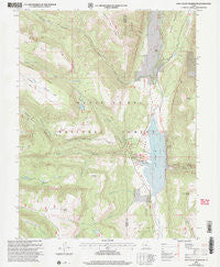
~ Joes Valley Reservoir UT topo map, 1:24000 scale, 7.5 X 7.5 Minute, Historical, 2001, updated 2004
Joes Valley Reservoir, Utah, USGS topographic map dated 2001.
Includes geographic coordinates (latitude and longitude). This topographic map is suitable for hiking, camping, and exploring, or framing it as a wall map.
Printed on-demand using high resolution imagery, on heavy weight and acid free paper, or alternatively on a variety of synthetic materials.
Topos available on paper, Waterproof, Poly, or Tyvek. Usually shipping rolled, unless combined with other folded maps in one order.
- Product Number: USGS-5458253
- Free digital map download (high-resolution, GeoPDF): Joes Valley Reservoir, Utah (file size: 12 MB)
- Map Size: please refer to the dimensions of the GeoPDF map above
- Weight (paper map): ca. 55 grams
- Map Type: POD USGS Topographic Map
- Map Series: HTMC
- Map Verison: Historical
- Cell ID: 22651
- Scan ID: 250033
- Imprint Year: 2004
- Woodland Tint: Yes
- Aerial Photo Year: 1997
- Edit Year: 2001
- Datum: NAD27
- Map Projection: Lambert Conformal Conic
- Map published by United States Geological Survey
- Map published by United States Forest Service
- Map Language: English
- Scanner Resolution: 600 dpi
- Map Cell Name: Joes Valley Reservoir
- Grid size: 7.5 X 7.5 Minute
- Date on map: 2001
- Map Scale: 1:24000
- Geographical region: Utah, United States
Neighboring Maps:
All neighboring USGS topo maps are available for sale online at a variety of scales.
Spatial coverage:
Topo map Joes Valley Reservoir, Utah, covers the geographical area associated the following places:
- Joes Valley Reservoir - Orange Olsen Administrative Site - Coyote Creek - Birch Spring Point - Indian Creek - Reeder Canyon - Academy Mill Reservoir - Joes Valley Campground - Grassy Lake - Dry Basin - Slide Lake - Wasatch Plateau - Fuller Creek - The Switchbacks - Olsen Bench - North Fork Swasey Creek - Academy Mill Reservoir Dam - White Knoll - Seely Creek - Littles Creek - Blue Lake - North Dragon Creek - South Fork Swasey Creek - Lowry Water - Thistle Flat - Marys Lake - Olsen Canyon - Grass Flat Reservoir - Sportsmans Lodge - Swasey Creek - Joes Valley Dam - Swasey Ridge - Bubs Creek - Reynold Point - Joes Valley Overlook - Reeder Ridge - Birch Spring - Clay Bank - Little Canyon - Wagon Road Ridge - Josephite Point - Seely Creek Campground - Joes Valley Marina - Clay Bench - Dragon Ridge - Lower Joes Valley - Bubs Meadow - Reeder Trail - Olsen Ranch - Kofford Creek - Grassy Lake Dam - Pauls Hole
- Map Area ID: AREA39.37539.25-111.375-111.25
- Northwest corner Lat/Long code: USGSNW39.375-111.375
- Northeast corner Lat/Long code: USGSNE39.375-111.25
- Southwest corner Lat/Long code: USGSSW39.25-111.375
- Southeast corner Lat/Long code: USGSSE39.25-111.25
- Northern map edge Latitude: 39.375
- Southern map edge Latitude: 39.25
- Western map edge Longitude: -111.375
- Eastern map edge Longitude: -111.25


