
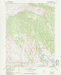
~ Island Park UT topo map, 1:24000 scale, 7.5 X 7.5 Minute, Historical, 1955, updated 1985
Island Park, Utah, USGS topographic map dated 1955.
Includes geographic coordinates (latitude and longitude). This topographic map is suitable for hiking, camping, and exploring, or framing it as a wall map.
Printed on-demand using high resolution imagery, on heavy weight and acid free paper, or alternatively on a variety of synthetic materials.
Topos available on paper, Waterproof, Poly, or Tyvek. Usually shipping rolled, unless combined with other folded maps in one order.
- Product Number: USGS-5458169
- Free digital map download (high-resolution, GeoPDF): Island Park, Utah (file size: 11 MB)
- Map Size: please refer to the dimensions of the GeoPDF map above
- Weight (paper map): ca. 55 grams
- Map Type: POD USGS Topographic Map
- Map Series: HTMC
- Map Verison: Historical
- Cell ID: 22155
- Scan ID: 249977
- Imprint Year: 1985
- Woodland Tint: Yes
- Photo Inspection Year: 1978
- Aerial Photo Year: 1978
- Field Check Year: 1955
- Datum: NAD27
- Map Projection: Polyconic
- Map published by United States Geological Survey
- Map Language: English
- Scanner Resolution: 600 dpi
- Map Cell Name: Island Park
- Grid size: 7.5 X 7.5 Minute
- Date on map: 1955
- Map Scale: 1:24000
- Geographical region: Utah, United States
Neighboring Maps:
All neighboring USGS topo maps are available for sale online at a variety of scales.
Spatial coverage:
Topo map Island Park, Utah, covers the geographical area associated the following places:
- Blair Draw - Rough Draw - Sixmile Draw - Garden Creek - Wolf Hollow - Lower Meadow - Rainbow Park - McKee Spring - Cottonwood Spring - McKee Bench - Mount Hawkins - Island Park Boat Launch Area - Rainbow Draw - Horse Trail Canyon - Tree Island - Limekiln Draw - Graveyard Draw - Stone Bridge Draw - Ford Island - Bobby Island - Upper Meadow - Ruple Ranch - Boone Spring - Island Park - Wagon Road Bench - Hog Island - Big Island - Buck Island - Diamond Mountain - Boone Ridge - Gorge Draw
- Map Area ID: AREA40.62540.5-109.25-109.125
- Northwest corner Lat/Long code: USGSNW40.625-109.25
- Northeast corner Lat/Long code: USGSNE40.625-109.125
- Southwest corner Lat/Long code: USGSSW40.5-109.25
- Southeast corner Lat/Long code: USGSSE40.5-109.125
- Northern map edge Latitude: 40.625
- Southern map edge Latitude: 40.5
- Western map edge Longitude: -109.25
- Eastern map edge Longitude: -109.125


