
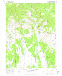
~ Ice Cave Peak UT topo map, 1:24000 scale, 7.5 X 7.5 Minute, Historical, 1965, updated 1978
Ice Cave Peak, Utah, USGS topographic map dated 1965.
Includes geographic coordinates (latitude and longitude). This topographic map is suitable for hiking, camping, and exploring, or framing it as a wall map.
Printed on-demand using high resolution imagery, on heavy weight and acid free paper, or alternatively on a variety of synthetic materials.
Topos available on paper, Waterproof, Poly, or Tyvek. Usually shipping rolled, unless combined with other folded maps in one order.
- Product Number: USGS-5458103
- Free digital map download (high-resolution, GeoPDF): Ice Cave Peak, Utah (file size: 11 MB)
- Map Size: please refer to the dimensions of the GeoPDF map above
- Weight (paper map): ca. 55 grams
- Map Type: POD USGS Topographic Map
- Map Series: HTMC
- Map Verison: Historical
- Cell ID: 21667
- Scan ID: 249929
- Imprint Year: 1978
- Woodland Tint: Yes
- Aerial Photo Year: 1962
- Field Check Year: 1965
- Datum: NAD27
- Map Projection: Polyconic
- Map published by United States Geological Survey
- Map published by United States Forest Service
- Map Language: English
- Scanner Resolution: 600 dpi
- Map Cell Name: Ice Cave Peak
- Grid size: 7.5 X 7.5 Minute
- Date on map: 1965
- Map Scale: 1:24000
- Geographical region: Utah, United States
Neighboring Maps:
All neighboring USGS topo maps are available for sale online at a variety of scales.
Spatial coverage:
Topo map Ice Cave Peak, Utah, covers the geographical area associated the following places:
- Hominy Creek - Upper Cart Hollow Springs - Cottonwood Spring - Sulphur Spring - Cuch Spring - Horricks Spring - Bull Pasture - Upper Big Tom Hollow Spring - Wild Horse Draw - Paradise Creek - The Hole - Farm Creek Bridge - Ice Cave Spring - Coal Mine Draw - Snake John Spring - Red Pine Spring - Elkhorn Guard Station - Ralphs Canyon - East Cart Hollow Reservoir - Buck Ridge - Red Knoll - Lower Big Tom Hollow Spring - Bridger Canyon - Reeds Cemetery - Whiterocks - Rat Spring - Cart Hollow Spring - Sand Point Spring - Murray Spring - Woodard Spring - Whiterocks Campground - Mosby Mountain - Cart Hollow - Farm Creek Grazing Enclosure - Loggers Cabin Park - Birch Spring - Bench Spring - Red Pine Canyon - Henry Olsen Draw - Elkhorn Trough - Whiterocks Canal - Farm Creek Canal - Bathtub Trough - Ice Cave Peak - Lees Hollow - Big Tom Hollow
- Map Area ID: AREA40.62540.5-110-109.875
- Northwest corner Lat/Long code: USGSNW40.625-110
- Northeast corner Lat/Long code: USGSNE40.625-109.875
- Southwest corner Lat/Long code: USGSSW40.5-110
- Southeast corner Lat/Long code: USGSSE40.5-109.875
- Northern map edge Latitude: 40.625
- Southern map edge Latitude: 40.5
- Western map edge Longitude: -110
- Eastern map edge Longitude: -109.875


