
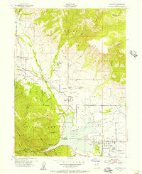
~ Huntsville UT topo map, 1:24000 scale, 7.5 X 7.5 Minute, Historical, 1955, updated 1956
Huntsville, Utah, USGS topographic map dated 1955.
Includes geographic coordinates (latitude and longitude). This topographic map is suitable for hiking, camping, and exploring, or framing it as a wall map.
Printed on-demand using high resolution imagery, on heavy weight and acid free paper, or alternatively on a variety of synthetic materials.
Topos available on paper, Waterproof, Poly, or Tyvek. Usually shipping rolled, unless combined with other folded maps in one order.
- Product Number: USGS-5458079
- Free digital map download (high-resolution, GeoPDF): Huntsville, Utah (file size: 12 MB)
- Map Size: please refer to the dimensions of the GeoPDF map above
- Weight (paper map): ca. 55 grams
- Map Type: POD USGS Topographic Map
- Map Series: HTMC
- Map Verison: Historical
- Cell ID: 21546
- Scan ID: 249911
- Imprint Year: 1956
- Woodland Tint: Yes
- Aerial Photo Year: 1953
- Field Check Year: 1955
- Survey Year: 1926
- Datum: NAD27
- Map Projection: Polyconic
- Map published by United States Geological Survey
- Map published by United States Army Corps of Engineers
- Map published by United States Army
- Map Language: English
- Scanner Resolution: 600 dpi
- Map Cell Name: Huntsville
- Grid size: 7.5 X 7.5 Minute
- Date on map: 1955
- Map Scale: 1:24000
- Geographical region: Utah, United States
Neighboring Maps:
All neighboring USGS topo maps are available for sale online at a variety of scales.
Spatial coverage:
Topo map Huntsville, Utah, covers the geographical area associated the following places:
- Robins Roost - Shannon Bee Estates - Liberty Meadows - Eden Meadows - Nordic Valley Estates - Big Sky Estates - Ogden Canyon Wildwood Estates - Wolf Creek - North Fork Estates - Pine View Park - Eden Village - Middle Fork Ranches - Casey Acres - Eden - Mountain View Estates - Silver Bell Estates - Pine View West - Ski/Lake Village Condominium - Spurlock - Gardens of Eden - Huntsville - Wolf Star - Patio Springs - Liberty - Wolf Creek Village - Eden Hills - Idlewild Townsite - Blake Holley - Wildwood - Willow Creek - Minnie Creek Estates - Wolf Lodge Condominium - Liberty Bell Ranchettes
- Map Area ID: AREA41.37541.25-111.875-111.75
- Northwest corner Lat/Long code: USGSNW41.375-111.875
- Northeast corner Lat/Long code: USGSNE41.375-111.75
- Southwest corner Lat/Long code: USGSSW41.25-111.875
- Southeast corner Lat/Long code: USGSSE41.25-111.75
- Northern map edge Latitude: 41.375
- Southern map edge Latitude: 41.25
- Western map edge Longitude: -111.875
- Eastern map edge Longitude: -111.75


