
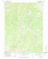
~ Hoyt Peak UT topo map, 1:24000 scale, 7.5 X 7.5 Minute, Historical, 1972, updated 1983
Hoyt Peak, Utah, USGS topographic map dated 1972.
Includes geographic coordinates (latitude and longitude). This topographic map is suitable for hiking, camping, and exploring, or framing it as a wall map.
Printed on-demand using high resolution imagery, on heavy weight and acid free paper, or alternatively on a variety of synthetic materials.
Topos available on paper, Waterproof, Poly, or Tyvek. Usually shipping rolled, unless combined with other folded maps in one order.
- Product Number: USGS-5458053
- Free digital map download (high-resolution, GeoPDF): Hoyt Peak, Utah (file size: 12 MB)
- Map Size: please refer to the dimensions of the GeoPDF map above
- Weight (paper map): ca. 55 grams
- Map Type: POD USGS Topographic Map
- Map Series: HTMC
- Map Verison: Historical
- Cell ID: 70430
- Scan ID: 249894
- Imprint Year: 1983
- Woodland Tint: Yes
- Visual Version Number: 1
- Aerial Photo Year: 1967
- Field Check Year: 1972
- Datum: NAD27
- Map Projection: Lambert Conformal Conic
- Map published by United States Geological Survey
- Map published by United States Forest Service
- Map Language: English
- Scanner Resolution: 600 dpi
- Map Cell Name: Hoyt Peak
- Grid size: 7.5 X 7.5 Minute
- Date on map: 1972
- Map Scale: 1:24000
- Geographical region: Utah, United States
Neighboring Maps:
All neighboring USGS topo maps are available for sale online at a variety of scales.
Spatial coverage:
Topo map Hoyt Peak, Utah, covers the geographical area associated the following places:
- Left-hand Canyon - Paulsin Basin - Lower Yellow Pine Lake - Kamas Wildlife Management Area - Weber Cottonwood Recreation Site - Bear Basin - Nobletts Creek - Cedar Fork - Pullem Creek - Upper Yellow Pine Lake - Yellow Pine Creek - Samak Census Designated Place - Wide Hollow - Shingle Mill Flat - Castle Lake - Yellow Pine Campground - Wasatch National Forest - Welch Creek - White Pine Creek - South Fork Weber River - Maxwells Creek - Castle Peak - Slate Creek - Swifts Canyon - Hoyt Peak
- Map Area ID: AREA40.7540.625-111.25-111.125
- Northwest corner Lat/Long code: USGSNW40.75-111.25
- Northeast corner Lat/Long code: USGSNE40.75-111.125
- Southwest corner Lat/Long code: USGSSW40.625-111.25
- Southeast corner Lat/Long code: USGSSE40.625-111.125
- Northern map edge Latitude: 40.75
- Southern map edge Latitude: 40.625
- Western map edge Longitude: -111.25
- Eastern map edge Longitude: -111.125


