
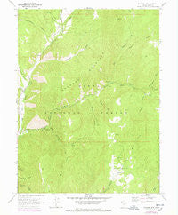
~ Granger Mtn UT topo map, 1:24000 scale, 7.5 X 7.5 Minute, Historical, 1967, updated 1978
Granger Mtn, Utah, USGS topographic map dated 1967.
Includes geographic coordinates (latitude and longitude). This topographic map is suitable for hiking, camping, and exploring, or framing it as a wall map.
Printed on-demand using high resolution imagery, on heavy weight and acid free paper, or alternatively on a variety of synthetic materials.
Topos available on paper, Waterproof, Poly, or Tyvek. Usually shipping rolled, unless combined with other folded maps in one order.
- Product Number: USGS-5457643
- Free digital map download (high-resolution, GeoPDF): Granger Mtn, Utah (file size: 13 MB)
- Map Size: please refer to the dimensions of the GeoPDF map above
- Weight (paper map): ca. 55 grams
- Map Type: POD USGS Topographic Map
- Map Series: HTMC
- Map Verison: Historical
- Cell ID: 18049
- Scan ID: 249587
- Imprint Year: 1978
- Woodland Tint: Yes
- Photo Revision Year: 1975
- Aerial Photo Year: 1963
- Edit Year: 1975
- Field Check Year: 1967
- Datum: NAD27
- Map Projection: Polyconic
- Map published by United States Geological Survey
- Map Language: English
- Scanner Resolution: 600 dpi
- Map Cell Name: Granger Mountain
- Grid size: 7.5 X 7.5 Minute
- Date on map: 1967
- Map Scale: 1:24000
- Geographical region: Utah, United States
Neighboring Maps:
All neighboring USGS topo maps are available for sale online at a variety of scales.
Spatial coverage:
Topo map Granger Mtn, Utah, covers the geographical area associated the following places:
- Hobble Creek Guard Station - Camp Hobble Creek - Dry Canyon Picnic Area - Grindstone Ridge - Granger Mountain - Kolob Campground - Jux Canyon - Packard Creek - Uinta National Forest - Bartholomew Canyon - Dry Canyon - Right Fork Dry Canyon - Wanrhodes Basin - Right Fork Days Canyon - Lone Fir Picnic Area - Days Canyon - Granger Canyon - Wardsworth Creek - Cedar Canyon - Balsam Campground - Birch Picnic Area - Left Fork Days Canyon - Whittemore Canyon - Red Pine Knoll - Cherry Picnic Area - Burnt Hollow - Pole Heaven - Sulphur Campground - Kirkman Hollow - Berryport Canyon
- Map Area ID: AREA40.2540.125-111.5-111.375
- Northwest corner Lat/Long code: USGSNW40.25-111.5
- Northeast corner Lat/Long code: USGSNE40.25-111.375
- Southwest corner Lat/Long code: USGSSW40.125-111.5
- Southeast corner Lat/Long code: USGSSE40.125-111.375
- Northern map edge Latitude: 40.25
- Southern map edge Latitude: 40.125
- Western map edge Longitude: -111.5
- Eastern map edge Longitude: -111.375


