
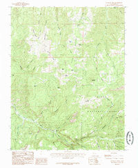
~ Flanigan Arch UT topo map, 1:24000 scale, 7.5 X 7.5 Minute, Historical, 1985, updated 1985
Flanigan Arch, Utah, USGS topographic map dated 1985.
Includes geographic coordinates (latitude and longitude). This topographic map is suitable for hiking, camping, and exploring, or framing it as a wall map.
Printed on-demand using high resolution imagery, on heavy weight and acid free paper, or alternatively on a variety of synthetic materials.
Topos available on paper, Waterproof, Poly, or Tyvek. Usually shipping rolled, unless combined with other folded maps in one order.
- Product Number: USGS-5457339
- Free digital map download (high-resolution, GeoPDF): Flanigan Arch, Utah (file size: 15 MB)
- Map Size: please refer to the dimensions of the GeoPDF map above
- Weight (paper map): ca. 55 grams
- Map Type: POD USGS Topographic Map
- Map Series: HTMC
- Map Verison: Historical
- Cell ID: 15472
- Scan ID: 249348
- Imprint Year: 1985
- Woodland Tint: Yes
- Aerial Photo Year: 1976
- Edit Year: 1985
- Field Check Year: 1980
- Datum: NAD27
- Map Projection: Lambert Conformal Conic
- Provisional map: Yes
- Map published by United States Geological Survey
- Map Language: English
- Scanner Resolution: 600 dpi
- Map Cell Name: Flanigan Arch
- Grid size: 7.5 X 7.5 Minute
- Date on map: 1985
- Map Scale: 1:24000
- Geographical region: Utah, United States
Neighboring Maps:
All neighboring USGS topo maps are available for sale online at a variety of scales.
Spatial coverage:
Topo map Flanigan Arch, Utah, covers the geographical area associated the following places:
- Eagle Peak - Rattlesnake Creek Trail - Sugarloaf Mountain - Cedar Mountain - Webb Canyon - MacFarlane Mine - Ashdown Gorge Wilderness - Stud Flat - Windy Ridge - Red Creek - Spring Creek - Dairy Hill - Cluff Mine - Shooting Star Creek - Lake Creek - Ashdown Creek - Long Hollow - High Mountain - Whiskey Hollow - Ashdoen Gorge Wilderness - Den Hollow - Right Hand Creek - Tri Story Canyon - Last Chance Canyon - First Lake - Martins Flat - Maple Canyon Creek - Grouse Spring - Tinks Racetrack - Deep Canyon - Bluebell Spring - Toms Lake - Jones Hill - Flanigan Arch - Potato Hollow - Big Hill - Third House Flat - Maple Canyon - Crow Creek - Calf Hollow - Middle Ridge - Pickering Creek - Rattlesnake Creek - Ellies Canyon - Avavick Knoll - Brown Creek - Hells Canyon - Eagle Spring - Summit Mountain
- Map Area ID: AREA37.7537.625-113-112.875
- Northwest corner Lat/Long code: USGSNW37.75-113
- Northeast corner Lat/Long code: USGSNE37.75-112.875
- Southwest corner Lat/Long code: USGSSW37.625-113
- Southeast corner Lat/Long code: USGSSE37.625-112.875
- Northern map edge Latitude: 37.75
- Southern map edge Latitude: 37.625
- Western map edge Longitude: -113
- Eastern map edge Longitude: -112.875


