
~ Flaming Gorge UT topo map, 1:24000 scale, 7.5 X 7.5 Minute, Historical, 1952, updated 1955
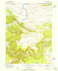
Flaming Gorge, Utah, USGS topographic map dated 1952.
Includes geographic coordinates (latitude and longitude). This topographic map is suitable for hiking, camping, and exploring, or framing it as a wall map.
Printed on-demand using high resolution imagery, on heavy weight and acid free paper, or alternatively on a variety of synthetic materials.
Topos available on paper, Waterproof, Poly, or Tyvek. Usually shipping rolled, unless combined with other folded maps in one order.
- Product Number: USGS-5457333
- Free digital map download (high-resolution, GeoPDF): Flaming Gorge, Utah (file size: 13 MB)
- Map Size: please refer to the dimensions of the GeoPDF map above
- Weight (paper map): ca. 55 grams
- Map Type: POD USGS Topographic Map
- Map Series: HTMC
- Map Verison: Historical
- Cell ID: 15463
- Scan ID: 249345
- Imprint Year: 1955
- Woodland Tint: Yes
- Aerial Photo Year: 1950
- Field Check Year: 1952
- Datum: NAD27
- Map Projection: Polyconic
- Map published by United States Geological Survey
- Map Language: English
- Scanner Resolution: 600 dpi
- Map Cell Name: Flaming Gorge
- Grid size: 7.5 X 7.5 Minute
- Date on map: 1952
- Map Scale: 1:24000
- Geographical region: Utah, United States
Neighboring Maps:
All neighboring USGS topo maps are available for sale online at a variety of scales.
Spatial coverage:
Topo map Flaming Gorge, Utah, covers the geographical area associated the following places:
- Eagle Basin - Flaming Gorge (historical) - Gooseneck Boat Camp - Spring Creek - Antelope Flat Campground - Red Canyon Picnic Area - Canyon Rim Campground - Bare Top Mountain - Lucerne Point Group Site - Lucerne Valley Development - Eagle Creek - West Fork Eagle Creek - Linwood Bay - Red Canyon Overlook - Daggett County - Flaming Gorge Valley - Red Canyon Visitor Center - Lucerne Valley Campground - Finch Draw - Red Canyon Visitor Center - Carter Creek - Buck Draw - Horseshoe Canyon - Lucerne Valley Campground - Hideout Eagle Basin Trail - Greens Lakes - Red Canyon Lodge - Trail Creek Ranch - Antelope Flat Campground - Boars Tusk - Antelope Flat Development - North Skull Creek - Lucerne Valley - Ashley Falls - Lucerne Valley Marina - Hideout Canyon - Chokecherry Draw - Skull Creek - Henrys Fork - Campbell Draw
- Map Area ID: AREA4140.875-109.625-109.5
- Northwest corner Lat/Long code: USGSNW41-109.625
- Northeast corner Lat/Long code: USGSNE41-109.5
- Southwest corner Lat/Long code: USGSSW40.875-109.625
- Southeast corner Lat/Long code: USGSSE40.875-109.5
- Northern map edge Latitude: 41
- Southern map edge Latitude: 40.875
- Western map edge Longitude: -109.625
- Eastern map edge Longitude: -109.5


