
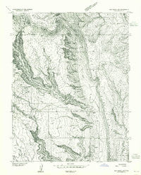
~ Elk Ridge 4 SW UT topo map, 1:24000 scale, 7.5 X 7.5 Minute, Historical, 1954
Elk Ridge 4 SW, Utah, USGS topographic map dated 1954.
Includes geographic coordinates (latitude and longitude). This topographic map is suitable for hiking, camping, and exploring, or framing it as a wall map.
Printed on-demand using high resolution imagery, on heavy weight and acid free paper, or alternatively on a variety of synthetic materials.
Topos available on paper, Waterproof, Poly, or Tyvek. Usually shipping rolled, unless combined with other folded maps in one order.
- Product Number: USGS-5457089
- Free digital map download (high-resolution, GeoPDF): Elk Ridge 4 SW, Utah (file size: 12 MB)
- Map Size: please refer to the dimensions of the GeoPDF map above
- Weight (paper map): ca. 55 grams
- Map Type: POD USGS Topographic Map
- Map Series: HTMC
- Map Verison: Historical
- Cell ID: 17579
- Scan ID: 249132
- Aerial Photo Year: 1953
- Datum: Unstated
- Map Projection: Unstated
- Preliminary map: Yes
- Map published by United States Geological Survey
- Keywords: Nonstandard Press Run
- Map Language: English
- Scanner Resolution: 600 dpi
- Map Cell Name: Gold Bar Canyon
- Grid size: 7.5 X 7.5 Minute
- Date on map: 1954
- Map Scale: 1:24000
- Geographical region: Utah, United States
Neighboring Maps:
All neighboring USGS topo maps are available for sale online at a variety of scales.
Spatial coverage:
Topo map Elk Ridge 4 SW, Utah, covers the geographical area associated the following places:
- Bootlegger Canyon - Little Valley - Bliss Bottom - Pinto Arch - Day Canyon - Dry Fork - Lake Bottom - Little Canyon - Amasa Back - The Jug Handle - Dead Horse Point State Park - Potash - Arths Pasture - Jackson Bottom - Ottingers Triple Arch - Dead Horse Point State Park - Gold Bar Canyon - Jackson Hole - Bull Canyon - Long Canyon - Day Canyon - Gold Bar - The Billboard - Gold Bar Arch - J L Eddy - Gemini Bridges
- Map Area ID: AREA38.62538.5-109.75-109.625
- Northwest corner Lat/Long code: USGSNW38.625-109.75
- Northeast corner Lat/Long code: USGSNE38.625-109.625
- Southwest corner Lat/Long code: USGSSW38.5-109.75
- Southeast corner Lat/Long code: USGSSE38.5-109.625
- Northern map edge Latitude: 38.625
- Southern map edge Latitude: 38.5
- Western map edge Longitude: -109.75
- Eastern map edge Longitude: -109.625


