
~ Elk Ridge 3 SW UT topo map, 1:24000 scale, 7.5 X 7.5 Minute, Historical, 1954
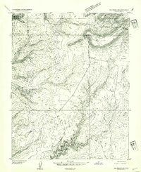
Elk Ridge 3 SW, Utah, USGS topographic map dated 1954.
Includes geographic coordinates (latitude and longitude). This topographic map is suitable for hiking, camping, and exploring, or framing it as a wall map.
Printed on-demand using high resolution imagery, on heavy weight and acid free paper, or alternatively on a variety of synthetic materials.
Topos available on paper, Waterproof, Poly, or Tyvek. Usually shipping rolled, unless combined with other folded maps in one order.
- Product Number: USGS-5457081
- Free digital map download (high-resolution, GeoPDF): Elk Ridge 3 SW, Utah (file size: 10 MB)
- Map Size: please refer to the dimensions of the GeoPDF map above
- Weight (paper map): ca. 55 grams
- Map Type: POD USGS Topographic Map
- Map Series: HTMC
- Map Verison: Historical
- Cell ID: 23031
- Scan ID: 249128
- Aerial Photo Year: 1952
- Datum: Unstated
- Map Projection: Unstated
- Preliminary map: Yes
- Map published by United States Geological Survey
- Keywords: Nonstandard Press Run
- Map Language: English
- Scanner Resolution: 600 dpi
- Map Cell Name: Kane Gulch
- Grid size: 7.5 X 7.5 Minute
- Date on map: 1954
- Map Scale: 1:24000
- Geographical region: Utah, United States
Neighboring Maps:
All neighboring USGS topo maps are available for sale online at a variety of scales.
Spatial coverage:
Topo map Elk Ridge 3 SW, Utah, covers the geographical area associated the following places:
- Kane Gulch Ranger Station - Lyman Canyon - Natural Bridges National Monument Campground - Junction Ruin - Blanding Division - Kane Gulch Trailhead - Stimper Arch - Kane Gulch - Turkey Pen Ruin - Maverick Point - Monument Valley Overlook - Fortress Canyon - Harmony Flat - Natural Bridges Recreation Site - Natural Bridges National Monument Visitor Center - Maverick Spring - Sphinx Rock - Grand Gulch Ranger Station - Hells Half Acre - Photovoltaic Array - Indian Park - Mormon Flat - Grand Flat - Hole in the Rock Trail - Turkey Pen Ruin - Junction Spring
- Map Area ID: AREA37.62537.5-110-109.875
- Northwest corner Lat/Long code: USGSNW37.625-110
- Northeast corner Lat/Long code: USGSNE37.625-109.875
- Southwest corner Lat/Long code: USGSSW37.5-110
- Southeast corner Lat/Long code: USGSSE37.5-109.875
- Northern map edge Latitude: 37.625
- Southern map edge Latitude: 37.5
- Western map edge Longitude: -110
- Eastern map edge Longitude: -109.875


