
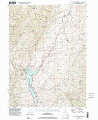
~ East Canyon Reservoir UT topo map, 1:24000 scale, 7.5 X 7.5 Minute, Historical, 1997, updated 2001
East Canyon Reservoir, Utah, USGS topographic map dated 1997.
Includes geographic coordinates (latitude and longitude). This topographic map is suitable for hiking, camping, and exploring, or framing it as a wall map.
Printed on-demand using high resolution imagery, on heavy weight and acid free paper, or alternatively on a variety of synthetic materials.
Topos available on paper, Waterproof, Poly, or Tyvek. Usually shipping rolled, unless combined with other folded maps in one order.
- Product Number: USGS-5456977
- Free digital map download (high-resolution, GeoPDF): East Canyon Reservoir, Utah (file size: 15 MB)
- Map Size: please refer to the dimensions of the GeoPDF map above
- Weight (paper map): ca. 55 grams
- Map Type: POD USGS Topographic Map
- Map Series: HTMC
- Map Verison: Historical
- Cell ID: 13347
- Scan ID: 249051
- Imprint Year: 2001
- Woodland Tint: Yes
- Aerial Photo Year: 1997
- Datum: NAD83
- Map Projection: Universal Transverse Mercator
- Map published by United States Geological Survey
- Map Language: English
- Scanner Resolution: 600 dpi
- Map Cell Name: East Canyon Reservoir
- Grid size: 7.5 X 7.5 Minute
- Date on map: 1997
- Map Scale: 1:24000
- Geographical region: Utah, United States
Neighboring Maps:
All neighboring USGS topo maps are available for sale online at a variety of scales.
Spatial coverage:
Topo map East Canyon Reservoir, Utah, covers the geographical area associated the following places:
- Parker Hollow - Hunts Meadow Creek - Saddle Rock - Right Fork Taylor Hollow - Dixie Hollow Springs - Dip Hollow - Taylor Hollow - East Canyon Dam - East Canyon State Park - East Canyon Reservoir - Hillman Hollow - Big Tree Creek - East Canyon Campground - Tom Porter Springs - Right Hand Fork Pollicks Canyon - Jack Beard Spring - Rocky Canyon - Rabbit Hollow - Hogback Summit - Lone Tree Canyon - Left Fork Taylor Hollow - Mardiths Canyon - Deer Fly Hollow - Redrock Peak - Route of Donner-Reed Party and Mormon Pioneers - Pollicks Canyon - Jodes Hollow - Bishops Canyon - Lone Tree Campsite - Dixie Spring - Thomas Canyon - Woodtick Hollow - Sawtooth Creek - Cottonwood Canyon - Hells Canyon - Rocky Ridge - Broad Hollow - Grants Grave - Spring Hollow - Rocky Hollow - Dixie Hollow - Site of Dixie Hollow Pony Express Station - Owens Meadow Hollow - Monument Creek - Tucson Hollow - Clark Spring - Dry Pine Creek - Dead Ox Canyon
- Map Area ID: AREA4140.875-111.625-111.5
- Northwest corner Lat/Long code: USGSNW41-111.625
- Northeast corner Lat/Long code: USGSNE41-111.5
- Southwest corner Lat/Long code: USGSSW40.875-111.625
- Southeast corner Lat/Long code: USGSSE40.875-111.5
- Northern map edge Latitude: 41
- Southern map edge Latitude: 40.875
- Western map edge Longitude: -111.625
- Eastern map edge Longitude: -111.5


