
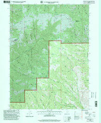
~ Bybee Knoll UT topo map, 1:24000 scale, 7.5 X 7.5 Minute, Historical, 1998, updated 2000
Bybee Knoll, Utah, USGS topographic map dated 1998.
Includes geographic coordinates (latitude and longitude). This topographic map is suitable for hiking, camping, and exploring, or framing it as a wall map.
Printed on-demand using high resolution imagery, on heavy weight and acid free paper, or alternatively on a variety of synthetic materials.
Topos available on paper, Waterproof, Poly, or Tyvek. Usually shipping rolled, unless combined with other folded maps in one order.
- Product Number: USGS-5456023
- Free digital map download (high-resolution, GeoPDF): Bybee Knoll, Utah (file size: 20 MB)
- Map Size: please refer to the dimensions of the GeoPDF map above
- Weight (paper map): ca. 55 grams
- Map Type: POD USGS Topographic Map
- Map Series: HTMC
- Map Verison: Historical
- Cell ID: 6535
- Scan ID: 248392
- Imprint Year: 2000
- Woodland Tint: Yes
- Aerial Photo Year: 1997
- Edit Year: 1998
- Datum: NAD27
- Map Projection: Lambert Conformal Conic
- Map published by United States Geological Survey
- Map published by United States Forest Service
- Map Language: English
- Scanner Resolution: 600 dpi
- Map Cell Name: Bybee Knoll
- Grid size: 7.5 X 7.5 Minute
- Date on map: 1998
- Map Scale: 1:24000
- Geographical region: Utah, United States
Neighboring Maps:
All neighboring USGS topo maps are available for sale online at a variety of scales.
Spatial coverage:
Topo map Bybee Knoll, Utah, covers the geographical area associated the following places:
- Middle Fork Guilder Sleeve Canyon - Maggie Hopkins Cottonwood Creek - Left Fork Guilder Sleeve Canyon - Long Hollow - Petes Canyon - Big Buck Canyon - Bybee Knoll - Right Fork Guilder Sleeve Canyon - Box Spring - Raymonds Hollow - Dry Canyon - Right Fork Pete Nelson Hollow - Willow Spring - Rock Spring - Little Buck Canyon - Cordwood Creek - Tom Condies Hollow - Devils Hollow - Tom Condies Flat - Herd Mountain - Cold Spring - Black Gulch - Goat Knoll - Morgan North Division - Berry Gulch - Willow Spring - Bybee Gulch - Box Canyon - Right Hand Fork Bybee Creek - Dry Hollow - Bybee Creek - Hoodoo Knoll
- Map Area ID: AREA41.2541.125-111.625-111.5
- Northwest corner Lat/Long code: USGSNW41.25-111.625
- Northeast corner Lat/Long code: USGSNE41.25-111.5
- Southwest corner Lat/Long code: USGSSW41.125-111.625
- Southeast corner Lat/Long code: USGSSE41.125-111.5
- Northern map edge Latitude: 41.25
- Southern map edge Latitude: 41.125
- Western map edge Longitude: -111.625
- Eastern map edge Longitude: -111.5


