
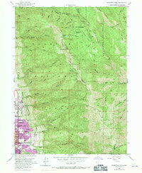
~ Bountiful Peak UT topo map, 1:24000 scale, 7.5 X 7.5 Minute, Historical, 1952, updated 1971
Bountiful Peak, Utah, USGS topographic map dated 1952.
Includes geographic coordinates (latitude and longitude). This topographic map is suitable for hiking, camping, and exploring, or framing it as a wall map.
Printed on-demand using high resolution imagery, on heavy weight and acid free paper, or alternatively on a variety of synthetic materials.
Topos available on paper, Waterproof, Poly, or Tyvek. Usually shipping rolled, unless combined with other folded maps in one order.
- Product Number: USGS-5455805
- Free digital map download (high-resolution, GeoPDF): Bountiful Peak, Utah (file size: 16 MB)
- Map Size: please refer to the dimensions of the GeoPDF map above
- Weight (paper map): ca. 55 grams
- Map Type: POD USGS Topographic Map
- Map Series: HTMC
- Map Verison: Historical
- Cell ID: 5003
- Scan ID: 248236
- Imprint Year: 1971
- Woodland Tint: Yes
- Photo Revision Year: 1969
- Aerial Photo Year: 1969
- Field Check Year: 1952
- Datum: NAD27
- Map Projection: Polyconic
- Map published by United States Geological Survey
- Map Language: English
- Scanner Resolution: 600 dpi
- Map Cell Name: Bountiful Peak
- Grid size: 7.5 X 7.5 Minute
- Date on map: 1952
- Map Scale: 1:24000
- Geographical region: Utah, United States
Neighboring Maps:
All neighboring USGS topo maps are available for sale online at a variety of scales.
Spatial coverage:
Topo map Bountiful Peak, Utah, covers the geographical area associated the following places:
- Horsely Circle - Rockwood Estates - Larsen Heights - Circle View Heights - Orchard Heights - Quailbrook - Moss Hill Drive - Hillside - Amby Briggs - Cottonwood Acres - Jensen - Val Mar - Lago Vista Circle - Brentwood Hills - Canyon Rim - Valley View Heights - Cinnamon Ridge - Twin Hollows - North Park - Bali Hai - Woodland - Bountiful Hills Estates - Holmes Estates - Eastwood Park - Hilltop Gardens - Burningham - Forest Park - Sheridan - Ellis Park - Rockwood Gardens - Lakeview Terrace - Centerville Acres - Maple Crest - Ern Hayes - Deuel Creek Heights - Bountiful Lake Hills - Cannon Hills - Granada Hills - Randall Way - Island View - Maple Glen - Northern Hills - Major - Reed - Colonial Gardens Condominium - Howard Estates - Smith - Gale - Vistaview - Sunset Heights - Lakeview Terrace Condominium - Briggs - Barlow - Glen Oaks - Canyon Crest - Three Fountains Bountiful Condominium - Vineyard - Pheasantridge Estates - Florece - B and B - Panorama - Brentwood Estates - Colonial Heights - Mountain Park - Crestwood - Cottonwood Heights - Bountiful Peak Summer Home Area - Woodmere - Woodland Hills Estates - Marlow - Ten Fifty East Circle - Alta Heights - Hillsdale - Ezra Clark - Van Orden Heights - Chandler - Hillcrest - Medical Drive Condominium - Centerville - Mount Lebannon Acres - Central Heights - Foothill Acres - Freestone Acres - Packlynn - Hilltop - North Hillsdale - Mount View - Bountiful Heights - The Hills Subdivisions - Eggett Estates - Cherry Circle - Orchard View - Holbrook Heights - Summers - Moss Hill
- Map Area ID: AREA4140.875-111.875-111.75
- Northwest corner Lat/Long code: USGSNW41-111.875
- Northeast corner Lat/Long code: USGSNE41-111.75
- Southwest corner Lat/Long code: USGSSW40.875-111.875
- Southeast corner Lat/Long code: USGSSE40.875-111.75
- Northern map edge Latitude: 41
- Southern map edge Latitude: 40.875
- Western map edge Longitude: -111.875
- Eastern map edge Longitude: -111.75


