
~ Black Mountain UT topo map, 1:24000 scale, 7.5 X 7.5 Minute, Historical, 2001, updated 2004
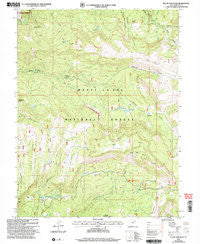
Black Mountain, Utah, USGS topographic map dated 2001.
Includes geographic coordinates (latitude and longitude). This topographic map is suitable for hiking, camping, and exploring, or framing it as a wall map.
Printed on-demand using high resolution imagery, on heavy weight and acid free paper, or alternatively on a variety of synthetic materials.
Topos available on paper, Waterproof, Poly, or Tyvek. Usually shipping rolled, unless combined with other folded maps in one order.
- Product Number: USGS-5455649
- Free digital map download (high-resolution, GeoPDF): Black Mountain, Utah (file size: 15 MB)
- Map Size: please refer to the dimensions of the GeoPDF map above
- Weight (paper map): ca. 55 grams
- Map Type: POD USGS Topographic Map
- Map Series: HTMC
- Map Verison: Historical
- Cell ID: 4152
- Scan ID: 248130
- Imprint Year: 2004
- Woodland Tint: Yes
- Aerial Photo Year: 1997
- Edit Year: 2001
- Datum: NAD27
- Map Projection: Lambert Conformal Conic
- Map published by United States Geological Survey
- Map published by United States Forest Service
- Map Language: English
- Scanner Resolution: 600 dpi
- Map Cell Name: Black Mountain
- Grid size: 7.5 X 7.5 Minute
- Date on map: 2001
- Map Scale: 1:24000
- Geographical region: Utah, United States
Neighboring Maps:
All neighboring USGS topo maps are available for sale online at a variety of scales.
Spatial coverage:
Topo map Black Mountain, Utah, covers the geographical area associated the following places:
- Hougaard Fork - North Fork Sixmile Canyon - Mount Baldy - Middle Mountain - Wildwest - Sixmile Ponds - Milk Creek - Julius Pasture - Loveridge Flat - Metcalf Spring - Upper Pond - Burnt Hill - Upper Ranch - Bub Arthurs Flat - Black Hole - Black Mountain - Lower Ranch - Patton Reservoir - Peacock Wildlife Management Area - Ephraim-Manti Division - Harmon Trail - Burnt Hill Flat - Newfield Reservoir - Bear Hole - Town Reservoir Dam - Leo Spring - Lower Pond - Dry Hole Reservoir - Milky Falls - Town Reservoir - White Ledges - Spring Hill - South Fork Sixmile Canyon - Grove of the Aspen Giants Scenic Area - Blue Meadows - Mount Baldy Guard Station
- Map Area ID: AREA39.2539.125-111.625-111.5
- Northwest corner Lat/Long code: USGSNW39.25-111.625
- Northeast corner Lat/Long code: USGSNE39.25-111.5
- Southwest corner Lat/Long code: USGSSW39.125-111.625
- Southeast corner Lat/Long code: USGSSE39.125-111.5
- Northern map edge Latitude: 39.25
- Southern map edge Latitude: 39.125
- Western map edge Longitude: -111.625
- Eastern map edge Longitude: -111.5


