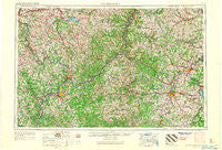
~ Clarksburg WV topo map, 1:250000 scale, 1 X 2 Degree, Historical, 1956, updated 1966
Clarksburg, West Virginia, USGS topographic map dated 1956.
Includes geographic coordinates (latitude and longitude). This topographic map is suitable for hiking, camping, and exploring, or framing it as a wall map.
Printed on-demand using high resolution imagery, on heavy weight and acid free paper, or alternatively on a variety of synthetic materials.
Topos available on paper, Waterproof, Poly, or Tyvek. Usually shipping rolled, unless combined with other folded maps in one order.
- Product Number: USGS-5416208
- Free digital map download (high-resolution, GeoPDF): Clarksburg, West Virginia (file size: 20 MB)
- Map Size: please refer to the dimensions of the GeoPDF map above
- Weight (paper map): ca. 55 grams
- Map Type: POD USGS Topographic Map
- Map Series: HTMC
- Map Verison: Historical
- Cell ID: 68718
- Scan ID: 701710
- Imprint Year: 1966
- Woodland Tint: Yes
- Edit Year: 1965
- Field Check Year: 1956
- Datum: Unstated
- Map Projection: Transverse Mercator
- Map published by United States Army
- Map Language: English
- Scanner Resolution: 508 dpi
- Map Cell Name: Clarksburg
- Grid size: 1 X 2 Degree
- Date on map: 1956
- Map Scale: 1:250000
- Geographical region: West Virginia, United States
Neighboring Maps:
All neighboring USGS topo maps are available for sale online at a variety of scales.
Spatial coverage:
Topo map Clarksburg, West Virginia, covers the geographical area associated the following places:
- Rolling Hills - Sand Hill - Clover Hill - Rushville - Wegee - Long Run - Dunbar - Pleasant Creek (historical) - Maken - Rees Mill - Burnt House - Muskingum Terrace - Van Dyne Trailer Court - Fairview - Stanley - Independence - O'Neill - East Salem - Oxford - Bowlby - Brister - Calcutta - Waynesburg - Romines Mills - McPherson Addition - Pike - Lone Cedar - Briggs - Brink - Price - Archers Fork - Big Run - Khedive - Grove - Denim Shack Mobile Home Park - West Union - Peeltree - Pitt Gas - Lubeck Hills - Smith Mill - Ruraldale - Troy - Buckeyeville - Volga - Slate - Wolf Run - Lightburn Acres - Temperanceville - Bellview - Chestnut Hills - Bald Hill - Deep Valley - Dean - Hutchinson - Eaton - Churchville - Saint Marys - Cranenest - Keno - Center (historical) - Greenwood - Harmar - Halls Mills - Blue - Benson - Buzz - Key - Parkers Towne - Tacoma - McClellan - Millsboro - Bluebell - Renrock - Rivesville - Garden Village - Liberty Hills - Horseneck - Cameron - Weston - Griffith - Smith Village - Hills - Park View - Broadwell - Quiet Dell - Helena - Bridgeway - Rix Mills - Wahoo - Jordan - Crabapple - Lashley - Cloud (historical) - Thoburn - Coxs Mills - Kingstown - Mill Grove - Childs - Circle Heights - Girta
- Map Area ID: AREA4039-82-80
- Northwest corner Lat/Long code: USGSNW40-82
- Northeast corner Lat/Long code: USGSNE40-80
- Southwest corner Lat/Long code: USGSSW39-82
- Southeast corner Lat/Long code: USGSSE39-80
- Northern map edge Latitude: 40
- Southern map edge Latitude: 39
- Western map edge Longitude: -82
- Eastern map edge Longitude: -80


