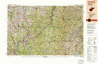
~ Clarksburg WV topo map, 1:250000 scale, 1 X 2 Degree, Historical, 1988, updated 1989
Clarksburg, West Virginia, USGS topographic map dated 1988.
Includes geographic coordinates (latitude and longitude). This topographic map is suitable for hiking, camping, and exploring, or framing it as a wall map.
Printed on-demand using high resolution imagery, on heavy weight and acid free paper, or alternatively on a variety of synthetic materials.
Topos available on paper, Waterproof, Poly, or Tyvek. Usually shipping rolled, unless combined with other folded maps in one order.
- Product Number: USGS-5416206
- Free digital map download (high-resolution, GeoPDF): Clarksburg, West Virginia (file size: 34 MB)
- Map Size: please refer to the dimensions of the GeoPDF map above
- Weight (paper map): ca. 55 grams
- Map Type: POD USGS Topographic Map
- Map Series: HTMC
- Map Verison: Historical
- Cell ID: 68718
- Scan ID: 254040
- Imprint Year: 1989
- Woodland Tint: Yes
- Edit Year: 1988
- Datum: NAD27
- Map Projection: Universal Transverse Mercator
- Map published by United States Geological Survey
- Map Language: English
- Scanner Resolution: 600 dpi
- Map Cell Name: Clarksburg
- Grid size: 1 X 2 Degree
- Date on map: 1988
- Map Scale: 1:250000
- Geographical region: West Virginia, United States
Neighboring Maps:
All neighboring USGS topo maps are available for sale online at a variety of scales.
Spatial coverage:
Topo map Clarksburg, West Virginia, covers the geographical area associated the following places:
- Teter - Pricetown - Folsom - Barker - Chiefton - Powell - Delaney (historical) - Elliotsville - Becket (historical) - Cresap - Dixie - Millersville - Zeno - Viola - Worthington - Pine Grove - Steelton - Santiago - Echo Point - Holman - West Finley - Howard - Maken - Belle Valley - Fly - Oak (historical) - East Norwood - Valley Falls - Clarksburg - Brill (historical) - Lumberport - Churchville - Market - Canton - Blennerhassett Island View Addition - Finch - Winding Road Addition - New Matamoras - Colfax - Rolling Stone Trailer Court - Wakefield - Layman - Sand Hill - Woodruff - Bristol - Clifton - Stockport - Wahanaker - Sun Valley - Adlai - Decker - Vorhies (historical) - Knob Fork - Peora - Pike - Loudenville - Wellington Heights - Merritt - Garards Fort - South Hills Estates - Rusk - Reader - Hunter - Four Mile - McDonald - Fort Grand - Sugar Camp - Bridgeville - Parkers Towne - Kirby - East Salem - Rushville - Dombey (historical) - Katy Lick - Peeltree - Quiet Dale - Davistown - Ross - Hohman - Nutter Farm - Trilby (historical) - Pinehurst - Woodland Addition - Howard (historical) - Highland - Teutonic (historical) - Frew - Kelsey (historical) - Lucasburg - Arbutus Park - Mount Carrick - Bert - Herlan - Canaanville - Garden Village - Rosebud - Everson - Rockport - Jane Lew - Benwood
- Map Area ID: AREA4039-82-80
- Northwest corner Lat/Long code: USGSNW40-82
- Northeast corner Lat/Long code: USGSNE40-80
- Southwest corner Lat/Long code: USGSSW39-82
- Southeast corner Lat/Long code: USGSSE39-80
- Northern map edge Latitude: 40
- Southern map edge Latitude: 39
- Western map edge Longitude: -82
- Eastern map edge Longitude: -80


