
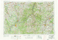
~ Clarksburg WV topo map, 1:250000 scale, 1 X 2 Degree, Historical, 1956, updated 1976
Clarksburg, West Virginia, USGS topographic map dated 1956.
Includes geographic coordinates (latitude and longitude). This topographic map is suitable for hiking, camping, and exploring, or framing it as a wall map.
Printed on-demand using high resolution imagery, on heavy weight and acid free paper, or alternatively on a variety of synthetic materials.
Topos available on paper, Waterproof, Poly, or Tyvek. Usually shipping rolled, unless combined with other folded maps in one order.
- Product Number: USGS-5416204
- Free digital map download (high-resolution, GeoPDF): Clarksburg, West Virginia (file size: 26 MB)
- Map Size: please refer to the dimensions of the GeoPDF map above
- Weight (paper map): ca. 55 grams
- Map Type: POD USGS Topographic Map
- Map Series: HTMC
- Map Verison: Historical
- Cell ID: 68718
- Scan ID: 254039
- Imprint Year: 1976
- Woodland Tint: Yes
- Photo Revision Year: 1965
- Field Check Year: 1956
- Datum: Unstated
- Map Projection: Transverse Mercator
- Map published by United States Geological Survey
- Map Language: English
- Scanner Resolution: 600 dpi
- Map Cell Name: Clarksburg
- Grid size: 1 X 2 Degree
- Date on map: 1956
- Map Scale: 1:250000
- Geographical region: West Virginia, United States
Neighboring Maps:
All neighboring USGS topo maps are available for sale online at a variety of scales.
Spatial coverage:
Topo map Clarksburg, West Virginia, covers the geographical area associated the following places:
- Fayal (historical) - Larkmead - Oral Lake - Five Points (historical) - Herlan - Cole - Beavertown - White Oak - Hunter (historical) - Bashan - Keno - West Milford - Frew - Core - Lone Cedar - Booth - Sandy - Cliffyville (historical) - Lynn Camp - Lee Creek - Becket (historical) - Bridgeville - Seeleyburg (historical) - Gypsy - Brokaw - Falls Mills - Creels - Wendel - Bucks Mill - Rockport (historical) - Three Forks - Sheets Mills - Viola - Meigs - Stewart - Nina - Woodruff - Pine Grove - Luke Chute - Kodol - Rushville - Mount Morris - Brierwood - Anthony - Vallonia - Riverview - Armstrongs Mills - Highland - Youba - Tappan - Armadale - Market - McClellan - Industrial - Wind Ridge - Peeltree - Center Point - Morgan Meadows Mobile Home Park - Lone Oak - Oak Grove - Fox Hall (historical) - Key - Stafford - Lubeck Hills - Porterfield - Crown - Jefferson - Brownton - Blennerhassett Heights - Sealover (historical) - Behler - McDonald - Crisp (historical) - Sue-Lin Acres - Hopewell - Dale - Riddle (historical) - Kings Mine - Donlan Heights - McConnelsville - New Gottingen - Stovertown - Lake Floyd - Fordyce - Glenbrook - Lovell - Twiggs - Wahanaker - Radcliff - Pullman - Federal (historical) - Hartzel - Garton Village - Mount Everett - Road Fork - Hoyt - Hoult - Halls Mills - Weston Manor - Keith
- Map Area ID: AREA4039-82-80
- Northwest corner Lat/Long code: USGSNW40-82
- Northeast corner Lat/Long code: USGSNE40-80
- Southwest corner Lat/Long code: USGSSW39-82
- Southeast corner Lat/Long code: USGSSE39-80
- Northern map edge Latitude: 40
- Southern map edge Latitude: 39
- Western map edge Longitude: -82
- Eastern map edge Longitude: -80


