
~ Charleston WV topo map, 1:250000 scale, 1 X 2 Degree, Historical, 1954, updated 1954
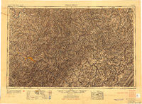
Charleston, West Virginia, USGS topographic map dated 1954.
Includes geographic coordinates (latitude and longitude). This topographic map is suitable for hiking, camping, and exploring, or framing it as a wall map.
Printed on-demand using high resolution imagery, on heavy weight and acid free paper, or alternatively on a variety of synthetic materials.
Topos available on paper, Waterproof, Poly, or Tyvek. Usually shipping rolled, unless combined with other folded maps in one order.
- Product Number: USGS-5416200
- Free digital map download (high-resolution, GeoPDF): Charleston, West Virginia (file size: 21 MB)
- Map Size: please refer to the dimensions of the GeoPDF map above
- Weight (paper map): ca. 55 grams
- Map Type: POD USGS Topographic Map
- Map Series: HTMC
- Map Verison: Historical
- Cell ID: 68709
- Scan ID: 701709
- Imprint Year: 1954
- Aerial Photo Year: 1946
- Datum: Unstated
- Map Projection: Transverse Mercator
- Shaded Relief map: Yes
- Map published by United States Army Corps of Engineers
- Map published by United States Army
- Map Language: English
- Scanner Resolution: 508 dpi
- Map Cell Name: Charleston
- Grid size: 1 X 2 Degree
- Date on map: 1954
- Map Scale: 1:250000
- Geographical region: West Virginia, United States
Neighboring Maps:
All neighboring USGS topo maps are available for sale online at a variety of scales.
Spatial coverage:
Topo map Charleston, West Virginia, covers the geographical area associated the following places:
- Jacox - Lantz - Middlebrook - Springdale Estates - German (historical) - Sunflower - Kanawha Drive - Halo - Morrison (historical) - Cutlips - Donald - Black Betsey - Kovan - Freeman - Republic - Georgetown - Flatfork - Ward - Marmet - Cherry Falls - Meadowdale - Harley - Cabot - Fishers Crossing - Spy Rock - Schilling Addition - Gay - Cuba - Triplett - Spring Hill - Westland Estates - Brady Gate - Charlton Heights - Woodzell - Gaines - Winsor Court - Ranch Lake Estates - Marvel - Sand Fork - Hansford - Nellis - Montgomery - White Pine - Camelot Village Mobile Home Park - Rushville - Monarch - Mark (historical) - Jingo (historical) - Gandeeville - Johns - Nuckolls - Harter - Chelyan - Arnoldsburg - Arcola - Porter - South Charleston - Crosby - Emma - Copen - Riverside - Hernshaw - Clendenin - Elana - Acup - Sanoma - Winfield - Thorny Creek - Diamond - Donwood - Hicumbottom - Beech Glen - Robson - Beech Park Acres - Bower - Teays Valley Estates - Dial - Enoch - McCuetown - Keslers Cross Lanes - Hollyhurst - Keith - Rocksdale - Cinco - Barren Creek - Pleasant View - Harriet - Holstead (historical) - Raymond City - Bulltown - Ripley Landing - Persinger - Alloy - Lockhart - Racine - Jefferson - Holly Hills Estates - Harlem Heights - Lick Fork - Clickton (historical)
- Map Area ID: AREA3938-82-80
- Northwest corner Lat/Long code: USGSNW39-82
- Northeast corner Lat/Long code: USGSNE39-80
- Southwest corner Lat/Long code: USGSSW38-82
- Southeast corner Lat/Long code: USGSSE38-80
- Northern map edge Latitude: 39
- Southern map edge Latitude: 38
- Western map edge Longitude: -82
- Eastern map edge Longitude: -80


