
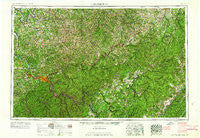
~ Charleston WV topo map, 1:250000 scale, 1 X 2 Degree, Historical, 1961, updated 1961
Charleston, West Virginia, USGS topographic map dated 1961.
Includes geographic coordinates (latitude and longitude). This topographic map is suitable for hiking, camping, and exploring, or framing it as a wall map.
Printed on-demand using high resolution imagery, on heavy weight and acid free paper, or alternatively on a variety of synthetic materials.
Topos available on paper, Waterproof, Poly, or Tyvek. Usually shipping rolled, unless combined with other folded maps in one order.
- Product Number: USGS-5416192
- Free digital map download (high-resolution, GeoPDF): Charleston, West Virginia (file size: 31 MB)
- Map Size: please refer to the dimensions of the GeoPDF map above
- Weight (paper map): ca. 55 grams
- Map Type: POD USGS Topographic Map
- Map Series: HTMC
- Map Verison: Historical
- Cell ID: 68709
- Scan ID: 254035
- Imprint Year: 1961
- Woodland Tint: Yes
- Aerial Photo Year: 1951
- Field Check Year: 1957
- Datum: Unstated
- Map Projection: Transverse Mercator
- Map Language: English
- Scanner Resolution: 600 dpi
- Map Cell Name: Charleston
- Grid size: 1 X 2 Degree
- Date on map: 1961
- Map Scale: 1:250000
- Geographical region: West Virginia, United States
Neighboring Maps:
All neighboring USGS topo maps are available for sale online at a variety of scales.
Spatial coverage:
Topo map Charleston, West Virginia, covers the geographical area associated the following places:
- Peytona - Winifrede Junction - Five Forks - Forks of Coal - Elverton - Dyer - The Y - Robertsburg - Gay - Joker - Goodwin - Rollyson - Liverpool - Griffithsville - Laing - Chesapeake - Russellville - Abbott - Lucas - Barren Creek - Allentown - Winfield - Raintown - Cowen - Springlea Estates - Southside - Saxon - Pleasant Hill - Hamilton - Gamoca - Van Camp - Valley Head - Selbyville - Wilson - Kanawha Drive - Donlan - Clawson - Harriet - Index (historical) - Swandale - Leo (historical) - Racine - Craddock - Wildcat - Finster - Osborne - Angerona - Hallburg - Teays Farm - Kaymoor - Mount Carbon - Carver (historical) - South Park - Fuquay (historical) - Shad (historical) - Kedron - Reedy - Nallen - Poplar Point Estates - Vandalia - Medina - Upper Leatherwood - Morrison (historical) - Parchment Valley - Willow Grove (historical) - Richwood - McDunn - Buckeye - Dial - Victor - Eskdale - Cicerone - Gauley Mills - Curtin - Winfield Way - Leewood - Powell Creek - Elkwater - Morrisvale - Morris (historical) - Milroy - Napier - Lizemores - Ayers - Monarch - Deegans - Mentor (historical) - Sutton - Parcoal - Sandyville - Lockhart - Losie (historical) - Glenville - Mingo - Dempsey - Sand Fork - Holswade Addition - New Era - Woodville - Rock Lake Village
- Map Area ID: AREA3938-82-80
- Northwest corner Lat/Long code: USGSNW39-82
- Northeast corner Lat/Long code: USGSNE39-80
- Southwest corner Lat/Long code: USGSSW38-82
- Southeast corner Lat/Long code: USGSSE38-80
- Northern map edge Latitude: 39
- Southern map edge Latitude: 38
- Western map edge Longitude: -82
- Eastern map edge Longitude: -80


