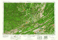
~ Bluefield WV topo map, 1:250000 scale, 1 X 2 Degree, Historical, 1961, updated 1961
Bluefield, West Virginia, USGS topographic map dated 1961.
Includes geographic coordinates (latitude and longitude). This topographic map is suitable for hiking, camping, and exploring, or framing it as a wall map.
Printed on-demand using high resolution imagery, on heavy weight and acid free paper, or alternatively on a variety of synthetic materials.
Topos available on paper, Waterproof, Poly, or Tyvek. Usually shipping rolled, unless combined with other folded maps in one order.
- Product Number: USGS-5416182
- Free digital map download (high-resolution, GeoPDF): Bluefield, West Virginia (file size: 29 MB)
- Map Size: please refer to the dimensions of the GeoPDF map above
- Weight (paper map): ca. 55 grams
- Map Type: POD USGS Topographic Map
- Map Series: HTMC
- Map Verison: Historical
- Cell ID: 68682
- Scan ID: 254032
- Imprint Year: 1961
- Woodland Tint: Yes
- Aerial Photo Year: 1956
- Field Check Year: 1957
- Datum: Unstated
- Map Projection: Transverse Mercator
- Map published by United States Geological Survey
- Map Language: English
- Scanner Resolution: 600 dpi
- Map Cell Name: Bluefield
- Grid size: 1 X 2 Degree
- Date on map: 1961
- Map Scale: 1:250000
- Geographical region: West Virginia, United States
Neighboring Maps:
All neighboring USGS topo maps are available for sale online at a variety of scales.
Spatial coverage:
Topo map Bluefield, West Virginia, covers the geographical area associated the following places:
- Oakvale - Fourway - Patterson - Judson - Glen Daniel - Steeles - Wyoming City - Thurmond - Maywood - Elgood - Mountain Lake - Simpsons - New Hope - Lee-Mitchell - Barrister Estates - Ramage - Knob Hill - Stover - Crumps Bottom - Loopemount - Alderson - Tinker (historical) - Junta (historical) - Narrows - White Stick (historical) - Pheasant Run - Prices Fork - Blue Sulphur Springs - Rocky Gap - Sundial - Mount Olivet - Sandlick - Kingston - Raleigh - Meadow Bridge - Youngs (historical) - Hales Bottom - Superior Bottom - Mountain Brook Estates - Riverland Court - Basin - Lamberts Store - Oak Manor - Blue Pennant - Bowes - Bruno - Ruth (historical) - Fairdale - Simmons - Skelton - Paynesville - Glen Cove - Glace - Dublin - Clear Fork Junction - Micco - Wolfcreek - Dry Hill - Burwell - Glade Road Heights - Marnie - Prudence - Neibert - Beverly Heights - Mouth of Laurel - Nemours - Roderfield - Hubbard Haven - Summit Hills - Algonquin (historical) - Snidow Heights - Scenic Hills - Whitewood - Dundas Heights - Forest Lawn - Princeton - West Park - Castle Rock West - Lyburn - Otsego - Garwood - Newport - Pineknob - Long Branch - Itmann - Wright - Carnot - Ravencliff - Robinette - Joe Neets - Suburban Hills - Jewell Ridge - Panorama Court - Dwight - Huff Acres - Middle Mountain (historical) - Yolyn - War Eagle - Covel - Beverly Heights North
- Map Area ID: AREA3837-82-80
- Northwest corner Lat/Long code: USGSNW38-82
- Northeast corner Lat/Long code: USGSNE38-80
- Southwest corner Lat/Long code: USGSSW37-82
- Southeast corner Lat/Long code: USGSSE37-80
- Northern map edge Latitude: 38
- Southern map edge Latitude: 37
- Western map edge Longitude: -82
- Eastern map edge Longitude: -80


