
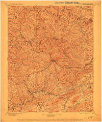
~ Tazewell VA topo map, 1:125000 scale, 30 X 30 Minute, Historical, 1897, updated 1912
Tazewell, Virginia, USGS topographic map dated 1897.
Includes geographic coordinates (latitude and longitude). This topographic map is suitable for hiking, camping, and exploring, or framing it as a wall map.
Printed on-demand using high resolution imagery, on heavy weight and acid free paper, or alternatively on a variety of synthetic materials.
Topos available on paper, Waterproof, Poly, or Tyvek. Usually shipping rolled, unless combined with other folded maps in one order.
- Product Number: USGS-5416168
- Free digital map download (high-resolution, GeoPDF): Tazewell, Virginia (file size: 9 MB)
- Map Size: please refer to the dimensions of the GeoPDF map above
- Weight (paper map): ca. 55 grams
- Map Type: POD USGS Topographic Map
- Map Series: HTMC
- Map Verison: Historical
- Cell ID: 66756
- Scan ID: 701507
- Imprint Year: 1912
- Survey Year: 1893
- Datum: Unstated
- Map Projection: Unstated
- Map published by United States Geological Survey
- Map Language: English
- Scanner Resolution: 508 dpi
- Map Cell Name: Tazewell
- Grid size: 30 X 30 Minute
- Date on map: 1897
- Map Scale: 1:125000
- Geographical region: Virginia, United States
Neighboring Maps:
All neighboring USGS topo maps are available for sale online at a variety of scales.
Spatial coverage:
Topo map Tazewell, Virginia, covers the geographical area associated the following places:
- Sayersville - River Jack - Berwind - Hale Creek - Krollitz - Stony Ridge - Marytown - Bartley - Carswell - Horn - Whites Store - Panther - Camp Tazewell - Fork Ridge - Gardner - Bearwallow - Marvin - Clell - Pucketts Store - Daw - Maiden Spring - Dye - Filbert - Atwell - Kimball - Jewell Valley - Bishop - Matney - Flatrock - Eight (historical) - Six - Indian - Caretta - Maitland - Hix (historical) - Hickory Junction - Swords Creek - Cedar Bluff - Newhall - Seaboard - Thompson Valley - Stacy - Beartown - Superior - Dan - Shack Mills - Jed - Rourkes Gap - Dunford Village - Cliffield - Frog Level - Richlands - Claypool Hill - Busthead - Dwight - Premier - Page - Red Ash - Elbert - Garland - Wolford - Coalwood - Canebrake - Venus - Brewsterdale - Peapatch - Tarkiln - Liberty - Grimsleyville - War - Erin - Steeleburg - Pounding Mill - Height - Keen Mountain - Big Sandy - Birmingham - Roth - Horsepen Cove - Sulphur Spring (historical) - Johnstown - Capels - Rockhouse - Yukon - Vallscreek - Russell - Coaldan - Jolo - Amonate - Gap Store - Maxwell - Twin Branch - Benbow - Honaker - Carlos - Marine - Tazewell - Shraders - Bevers Store (historical) - Afredton
- Map Area ID: AREA37.537-82-81.5
- Northwest corner Lat/Long code: USGSNW37.5-82
- Northeast corner Lat/Long code: USGSNE37.5-81.5
- Southwest corner Lat/Long code: USGSSW37-82
- Southeast corner Lat/Long code: USGSSE37-81.5
- Northern map edge Latitude: 37.5
- Southern map edge Latitude: 37
- Western map edge Longitude: -82
- Eastern map edge Longitude: -81.5


