
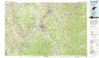
~ Parkersburg WV topo map, 1:100000 scale, 30 X 60 Minute, Historical, 1981, updated 1984
Parkersburg, West Virginia, USGS topographic map dated 1981.
Includes geographic coordinates (latitude and longitude). This topographic map is suitable for hiking, camping, and exploring, or framing it as a wall map.
Printed on-demand using high resolution imagery, on heavy weight and acid free paper, or alternatively on a variety of synthetic materials.
Topos available on paper, Waterproof, Poly, or Tyvek. Usually shipping rolled, unless combined with other folded maps in one order.
- Product Number: USGS-5416116
- Free digital map download (high-resolution, GeoPDF): Parkersburg, West Virginia (file size: 34 MB)
- Map Size: please refer to the dimensions of the GeoPDF map above
- Weight (paper map): ca. 55 grams
- Map Type: POD USGS Topographic Map
- Map Series: HTMC
- Map Verison: Historical
- Cell ID: 72185
- Scan ID: 701704
- Imprint Year: 1984
- Woodland Tint: Yes
- Aerial Photo Year: 1976
- Edit Year: 1981
- Datum: NAD27
- Map Projection: Universal Transverse Mercator
- Map published by United States Geological Survey
- Map Language: English
- Scanner Resolution: 508 dpi
- Map Cell Name: Parkersburg
- Grid size: 30 X 60 Minute
- Date on map: 1981
- Map Scale: 1:100000
- Geographical region: West Virginia, United States
Neighboring Maps:
All neighboring USGS topo maps are available for sale online at a variety of scales.
Spatial coverage:
Topo map Parkersburg, West Virginia, covers the geographical area associated the following places:
- Broadmoor Addition - Pleasants - Ellenboro - Vaucluse - Belpre - Pinegrove - Lathrop - Ogden - Barlow - Slate - Mercers Mobile Home Park - Prunty - North Parkersburg - Long Reach - Ireland - South Hills Estates - Minersville - Murphy - Glenbrook - Topins Grove - Guysville - Dunham - Lincolnshire - Hazael - Rushville - Alfred - Flatwoods - Success - Cokeleys - Bartlett - Garden - Stiversville - Boreman - New England Heights Addition - Norwood - Pleasant Hill - Dutchtown - Constitution - Wells Subdivision - Six Hill - New England - Torch - Marrtown - Chesterhill - Reno - Lytton (historical) - Fillmore - Sandhill - Highland - Bevan - Cantwell - Cairo - Reedsville - Calcutta - Meadville - Denim Shack Mobile Home Park - Leachtown - Green Run - Hockingport - Fairview Acres - Merritt - Riverview - Morgan - Leith - Westview - Melrose Addition - Dell - Hull - Bald Knobs - Enterprise - Pond Creek - Lone Cedar - Wiley - Weekleys (historical) - Beechwood - Beatysville (historical) - Schley - Coolville - Elmwood Heights - Eli - Morningside - Vanderhoof - Crestview Park - Chesterville - Ashby Ridge Estates - North Hills - Locust Fork - Winding Road Addition - Arlington Heights - Eva - Marietta - Stewart - Morristown - Oil Spring - White Rock (historical) - Smithville - Woodland Park - Tavennersville - Stewart - Greencastle
- Map Area ID: AREA39.539-82-81
- Northwest corner Lat/Long code: USGSNW39.5-82
- Northeast corner Lat/Long code: USGSNE39.5-81
- Southwest corner Lat/Long code: USGSSW39-82
- Southeast corner Lat/Long code: USGSSE39-81
- Northern map edge Latitude: 39.5
- Southern map edge Latitude: 39
- Western map edge Longitude: -82
- Eastern map edge Longitude: -81


