
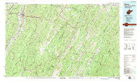
~ Elkins WV topo map, 1:100000 scale, 30 X 60 Minute, Historical, 1981, updated 1983
Elkins, West Virginia, USGS topographic map dated 1981.
Includes geographic coordinates (latitude and longitude). This topographic map is suitable for hiking, camping, and exploring, or framing it as a wall map.
Printed on-demand using high resolution imagery, on heavy weight and acid free paper, or alternatively on a variety of synthetic materials.
Topos available on paper, Waterproof, Poly, or Tyvek. Usually shipping rolled, unless combined with other folded maps in one order.
- Product Number: USGS-5416100
- Free digital map download (high-resolution, GeoPDF): Elkins, West Virginia (file size: 28 MB)
- Map Size: please refer to the dimensions of the GeoPDF map above
- Weight (paper map): ca. 55 grams
- Map Type: POD USGS Topographic Map
- Map Series: HTMC
- Map Verison: Historical
- Cell ID: 67472
- Scan ID: 701696
- Imprint Year: 1983
- Woodland Tint: Yes
- Aerial Photo Year: 1977
- Edit Year: 1981
- Datum: NAD27
- Map Projection: Universal Transverse Mercator
- Map published by United States Geological Survey
- Map Language: English
- Scanner Resolution: 508 dpi
- Map Cell Name: Elkins
- Grid size: 30 X 60 Minute
- Date on map: 1981
- Map Scale: 1:100000
- Geographical region: West Virginia, United States
Neighboring Maps:
All neighboring USGS topo maps are available for sale online at a variety of scales.
Spatial coverage:
Topo map Elkins, West Virginia, covers the geographical area associated the following places:
- Braucher - Crystal Springs - Cheat Junction - Harper - Cherry Grove - Montes (historical) - Huttonsville - White (historical) - Jenningston - Canfield - Job - Deer Run - Oak Grove - Gage - Bemis - Weese - Seemly (historical) - Zigler - Sully - Read - Durgon - Durbin - Mozer - Judy Gap - Weaver - Glenmore - Whyte - Leadsville - Little Italy - Bartow - Burner - Horton - Meadows - Hiser (historical) - Valley Bend - Simoda - Sullivan - Kuntzville (historical) - Kline - Highland Park - East Dailey - Wymer - Wyoming (historical) - Osceola - Whitmer - Greenbrier Junction - Onego - Mill Creek - Gilman - Glady - Mitchell - Circleville - Fame - Dry Run - Franklin - Beverly - Sweedlin - Teterton - Lumber (historical) - Mabie - Milam - Riverton - Macksville - Jeff Scotts (historical) - Moatstown - Leiter (historical) - Skidmore (historical) - Laurel (historical) - Nottingham - Dryfork - Gandy - Fort Seybert - Dorcas - Fairview - Aggregates - Pansy - Upper Tract - Rawley Springs - Clines Hacking - Harding - May - Brandywine - Laneville - Key (historical) - Midland - Fisher (historical) - Bass - Junior - Evenwood - Stringtown (historical) - Dartmoor - Hazelwood (historical) - Brake - Sugar Grove - Bowden - Coalton - Criders - Blue Grass - Elkins - Moyers
- Map Area ID: AREA3938.5-80-79
- Northwest corner Lat/Long code: USGSNW39-80
- Northeast corner Lat/Long code: USGSNE39-79
- Southwest corner Lat/Long code: USGSSW38.5-80
- Southeast corner Lat/Long code: USGSSE38.5-79
- Northern map edge Latitude: 39
- Southern map edge Latitude: 38.5
- Western map edge Longitude: -80
- Eastern map edge Longitude: -79


