
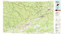
~ Bluefield WV topo map, 1:100000 scale, 30 X 60 Minute, Historical, 1981, updated 1988
Bluefield, West Virginia, USGS topographic map dated 1981.
Includes geographic coordinates (latitude and longitude). This topographic map is suitable for hiking, camping, and exploring, or framing it as a wall map.
Printed on-demand using high resolution imagery, on heavy weight and acid free paper, or alternatively on a variety of synthetic materials.
Topos available on paper, Waterproof, Poly, or Tyvek. Usually shipping rolled, unless combined with other folded maps in one order.
- Product Number: USGS-5416092
- Free digital map download (high-resolution, GeoPDF): Bluefield, West Virginia (file size: 28 MB)
- Map Size: please refer to the dimensions of the GeoPDF map above
- Weight (paper map): ca. 55 grams
- Map Type: POD USGS Topographic Map
- Map Series: HTMC
- Map Verison: Historical
- Cell ID: 72141
- Scan ID: 701692
- Imprint Year: 1988
- Woodland Tint: Yes
- Aerial Photo Year: 1977
- Edit Year: 1981
- Datum: NAD27
- Map Projection: Universal Transverse Mercator
- Map published by United States Geological Survey
- Map Language: English
- Scanner Resolution: 508 dpi
- Map Cell Name: Bluefield
- Grid size: 30 X 60 Minute
- Date on map: 1981
- Map Scale: 1:100000
- Geographical region: West Virginia, United States
Neighboring Maps:
All neighboring USGS topo maps are available for sale online at a variety of scales.
Spatial coverage:
Topo map Bluefield, West Virginia, covers the geographical area associated the following places:
- Squire - Jewell Valley - Gardner Junction - Elkhorn - Gap Store - North Tazewell - Rourkes Gap - Nacols - Matney - Hiawatha - Fork Ridge - Clear Fork - Van Dyke - Bevers Store (historical) - Yards - Freeman - Adria - Maple Acre - Glenwood - Honaker - Criggers - Putnam - Marytown - Patterson - Bastian - Erin - Busthead - Dunford Village - Byron - Skygusty - Jenkinjones - Union City - North Gap - Gose Mill - Cumberland Heights - Paintlick - Shortt Gap - Laurel - Cliffield - Yerba - Kegley - Vivian - Maitland - McCall Place - Benbolt - Russell - Maxwell - Northfork - Point Pleasant - Lake Shawnee - Superior - Liberty - New Hope - Grimsleyville - Abbs Valley - Five Oaks - Falls Mills - Frog Level - Maybeury - Raven - Daw - Wittens Mills - Hensley - Hix (historical) - Upland - Yukon - Tarkiln - Bethel (historical) - Pisgah - Billie (historical) - Bailey - Burkes Garden - Maiden Spring - Abbs Valley (historical) - Thompson Valley - Wimmers Trailer Park - Benbow - Iaeger - Drytown - Goodwill - Stacy - Suiter - Sam - Seaboard - Gilliam - Lex - Kale - Maple View - Fourway - Ruth (historical) - Canebrake - Eight (historical) - Lamar - Blackey - Big Four - Bradshaw - Warriormine - Sulphur Spring (historical) - Joe Neets - Filbert
- Map Area ID: AREA37.537-82-81
- Northwest corner Lat/Long code: USGSNW37.5-82
- Northeast corner Lat/Long code: USGSNE37.5-81
- Southwest corner Lat/Long code: USGSSW37-82
- Southeast corner Lat/Long code: USGSSE37-81
- Northern map edge Latitude: 37.5
- Southern map edge Latitude: 37
- Western map edge Longitude: -82
- Eastern map edge Longitude: -81


