
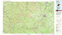
~ Beckley WV topo map, 1:100000 scale, 30 X 60 Minute, Historical, 1982, updated 1984
Beckley, West Virginia, USGS topographic map dated 1982.
Includes geographic coordinates (latitude and longitude). This topographic map is suitable for hiking, camping, and exploring, or framing it as a wall map.
Printed on-demand using high resolution imagery, on heavy weight and acid free paper, or alternatively on a variety of synthetic materials.
Topos available on paper, Waterproof, Poly, or Tyvek. Usually shipping rolled, unless combined with other folded maps in one order.
- Product Number: USGS-5416088
- Free digital map download (high-resolution, GeoPDF): Beckley, West Virginia (file size: 32 MB)
- Map Size: please refer to the dimensions of the GeoPDF map above
- Weight (paper map): ca. 55 grams
- Map Type: POD USGS Topographic Map
- Map Series: HTMC
- Map Verison: Historical
- Cell ID: 67118
- Scan ID: 701690
- Imprint Year: 1984
- Woodland Tint: Yes
- Aerial Photo Year: 1976
- Edit Year: 1982
- Datum: NAD27
- Map Projection: Universal Transverse Mercator
- Map published by United States Geological Survey
- Map Language: English
- Scanner Resolution: 508 dpi
- Map Cell Name: Beckley
- Grid size: 30 X 60 Minute
- Date on map: 1982
- Map Scale: 1:100000
- Geographical region: West Virginia, United States
Neighboring Maps:
All neighboring USGS topo maps are available for sale online at a variety of scales.
Spatial coverage:
Topo map Beckley, West Virginia, covers the geographical area associated the following places:
- Crow - Dimmock - Blackeagle - Lanta - Gilbert Creek - Sundial - Gilbert - Coal Mountain - Rock Creek - Emerson - Circle View - Wickham - Export (historical) - Pennbrook (historical) - Van - Beury - Greenstown - McConnell - Logan - Pettus - Lick Fork - Wingrove - Earling - Sanger - Willibet - Hanover - Hoohoo - United - Dehue - Leevale - Rosedale - Kopperston - Rock View - Sweeneyburg - Lively - Secoal - McAlpin - Marthatown - Amherstdale - Concho - Epperly - Tilden - Craneco - Isom - Stonewall (historical) - Hamlet (historical) - Prince - Baileysville - Roseville (historical) - Red Campbell - Sophia - McGraws - Maple Fork - Helen - Maben - Whipple - Joe Branch - West Logan - Abney - Leatherwood - Rossmore - Ameagle - Cazy - Milam - Maple Meadow - Rum Junction - Sprattsville - Chambers - Colcord - Cabell - Clothier - Slagle - Redbird - Ury - Mifflin - Old Mill Village - Warden - Wharton - Glen Rogers - Cirtsville - Wharncliffe - Echart (historical) - Buskirk Addition - Tralee - Pax - Egeria - Landville - Five Block - Windom - Greenville - Naoma - Dorothy - North Mitchell Heights - Cunard - Lorado - Fairdale - Zada - Chauncey - Manila - Glade Springs
- Map Area ID: AREA3837.5-82-81
- Northwest corner Lat/Long code: USGSNW38-82
- Northeast corner Lat/Long code: USGSNE38-81
- Southwest corner Lat/Long code: USGSSW37.5-82
- Southeast corner Lat/Long code: USGSSE37.5-81
- Northern map edge Latitude: 38
- Southern map edge Latitude: 37.5
- Western map edge Longitude: -82
- Eastern map edge Longitude: -81


