
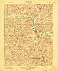
~ Saint Albans WV topo map, 1:62500 scale, 15 X 15 Minute, Historical, 1909
Saint Albans, West Virginia, USGS topographic map dated 1909.
Includes geographic coordinates (latitude and longitude). This topographic map is suitable for hiking, camping, and exploring, or framing it as a wall map.
Printed on-demand using high resolution imagery, on heavy weight and acid free paper, or alternatively on a variety of synthetic materials.
Topos available on paper, Waterproof, Poly, or Tyvek. Usually shipping rolled, unless combined with other folded maps in one order.
- Product Number: USGS-5415866
- Free digital map download (high-resolution, GeoPDF): Saint Albans, West Virginia (file size: 11 MB)
- Map Size: please refer to the dimensions of the GeoPDF map above
- Weight (paper map): ca. 55 grams
- Map Type: POD USGS Topographic Map
- Map Series: HTMC
- Map Verison: Historical
- Cell ID: 61914
- Scan ID: 253841
- Survey Year: 1907
- Datum: Unstated
- Map Projection: Unstated
- Map published by United States Geological Survey
- Map Language: English
- Scanner Resolution: 600 dpi
- Map Cell Name: Saint Albans
- Grid size: 15 X 15 Minute
- Date on map: 1909
- Map Scale: 1:62500
- Geographical region: West Virginia, United States
Neighboring Maps:
All neighboring USGS topo maps are available for sale online at a variety of scales.
Spatial coverage:
Topo map Saint Albans, West Virginia, covers the geographical area associated the following places:
- Teays Village - Country Villas - Beech Park Acres - Teays Valley Meadows - Woods and Irons South - Teays - Cherry Grove - Sleepy Hollow Township - Mount Vernon Meadows - Oakwood Estates - Twin Rivers Mobile Home Park - Woodcliffe Chase - Cheyenne Valley - Ferrell - Hickory Hill - Marlaina Addition - Tyler Heights - Teays Valley - Fairview - Fairway Gardens - Teays Farm - Riverlake - Tango - Poplar Point Estates - Raymond City - Parkway Terrace - Sun Valley Estates - Teays Meadow - Black Lick Estates - Fuquay (historical) - Green Valley - Woods and Irons - The Ridge Estates - Sweet Acres - Lexington Estates - Colonial Gardens - Amandaville - Saint Albans - Glass Addition - Lone Oak Park - Strawberry Heights - Autumn Wynds - Jefferson - Alum Creek - Forks of Coal - Dogwood Estates - Nitro - Valley View Estates - Belle Acres - East Nitro - Tornado - Saunders Addition - Ortin Heights - Calvert (historical) - Black Betsey - Highlawn - Roseville Addition - Teays Valley Estates - Rolling Meadows - Poca - Arborland Acres - Indian (historical) - Sattes - Lower Falls - Springlea Estates - River Bend - Scott Village - Teays Villa - Hidden Valley Estates - Ranch Lake Estates - Garretts Bend - Woods and Irons East - Cross Lanes - Valley Brook Mobile Home Park - Virginia Heights - Candlewyck Place - Baker Park - Lincoln (historical) - Riverside Mobile Home Park - Rock Branch - Morgans Landing - Riverdale Acres - Silver Valley Estates - Institute - Sproul - Windsong Acres - Kenmar Trailer Park - Ballard (historical) - Englewood Estates - Winsor Court - Scary - Sun Valley - Springdale Estates - Scott Depot - Belvil Park - Priestley - Lincoln Park
- Map Area ID: AREA38.538.25-82-81.75
- Northwest corner Lat/Long code: USGSNW38.5-82
- Northeast corner Lat/Long code: USGSNE38.5-81.75
- Southwest corner Lat/Long code: USGSSW38.25-82
- Southeast corner Lat/Long code: USGSSE38.25-81.75
- Northern map edge Latitude: 38.5
- Southern map edge Latitude: 38.25
- Western map edge Longitude: -82
- Eastern map edge Longitude: -81.75


