
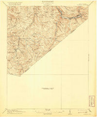
~ Richwood WV topo map, 1:62500 scale, 15 X 15 Minute, Historical, 1918, updated 1920
Richwood, West Virginia, USGS topographic map dated 1918.
Includes geographic coordinates (latitude and longitude). This topographic map is suitable for hiking, camping, and exploring, or framing it as a wall map.
Printed on-demand using high resolution imagery, on heavy weight and acid free paper, or alternatively on a variety of synthetic materials.
Topos available on paper, Waterproof, Poly, or Tyvek. Usually shipping rolled, unless combined with other folded maps in one order.
- Product Number: USGS-5415824
- Free digital map download (high-resolution, GeoPDF): Richwood, West Virginia (file size: 6 MB)
- Map Size: please refer to the dimensions of the GeoPDF map above
- Weight (paper map): ca. 55 grams
- Map Type: POD USGS Topographic Map
- Map Series: HTMC
- Map Verison: Historical
- Cell ID: 61601
- Scan ID: 253817
- Imprint Year: 1920
- Survey Year: 1915
- Datum: Unstated
- Map Projection: Unstated
- Preliminary map: Yes
- Map published by United States Geological Survey
- Map Language: English
- Scanner Resolution: 600 dpi
- Map Cell Name: Richmond
- Grid size: 15 X 15 Minute
- Date on map: 1918
- Map Scale: 1:62500
- Geographical region: West Virginia, United States
Neighboring Maps:
All neighboring USGS topo maps are available for sale online at a variety of scales.
Spatial coverage:
Topo map Richwood, West Virginia, covers the geographical area associated the following places:
- Richwood - Duo - Leslie - Fenwick - LaFrank - Jetsville - McClung (historical) - Leivasy - Marfrance - Ophelia (historical) - Quinwood - Bryant (historical) - Walker Hill (historical) - Tolbert - Crichton - Grassy Falls - Charmco - Saxman - Orient Hill - Clearco - Cobb - Green Valley - Hominy Falls - Carl - Lile - Nettie - Odell Town - Bellburn - Anjean
- Map Area ID: AREA38.2538-80.75-80.5
- Northwest corner Lat/Long code: USGSNW38.25-80.75
- Northeast corner Lat/Long code: USGSNE38.25-80.5
- Southwest corner Lat/Long code: USGSSW38-80.75
- Southeast corner Lat/Long code: USGSSE38-80.5
- Northern map edge Latitude: 38.25
- Southern map edge Latitude: 38
- Western map edge Longitude: -80.75
- Eastern map edge Longitude: -80.5


