
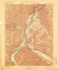
~ Point Pleasant WV topo map, 1:62500 scale, 15 X 15 Minute, Historical, 1908, updated 1920
Point Pleasant, West Virginia, USGS topographic map dated 1908.
Includes geographic coordinates (latitude and longitude). This topographic map is suitable for hiking, camping, and exploring, or framing it as a wall map.
Printed on-demand using high resolution imagery, on heavy weight and acid free paper, or alternatively on a variety of synthetic materials.
Topos available on paper, Waterproof, Poly, or Tyvek. Usually shipping rolled, unless combined with other folded maps in one order.
- Product Number: USGS-5415802
- Free digital map download (high-resolution, GeoPDF): Point Pleasant, West Virginia (file size: 12 MB)
- Map Size: please refer to the dimensions of the GeoPDF map above
- Weight (paper map): ca. 55 grams
- Map Type: POD USGS Topographic Map
- Map Series: HTMC
- Map Verison: Historical
- Cell ID: 61118
- Scan ID: 253802
- Imprint Year: 1920
- Survey Year: 1906
- Datum: Unstated
- Map Projection: Unstated
- Map published by United States Geological Survey
- Map Language: English
- Scanner Resolution: 600 dpi
- Map Cell Name: Point Pleasant
- Grid size: 15 X 15 Minute
- Date on map: 1908
- Map Scale: 1:62500
- Geographical region: West Virginia, United States
Neighboring Maps:
All neighboring USGS topo maps are available for sale online at a variety of scales.
Spatial coverage:
Topo map Point Pleasant, West Virginia, covers the geographical area associated the following places:
- Beech Hill - Grandview Estates - Lawnview - Heights - Gilmore Heights - Bellmeade - Pleasant Valley Estates - Brighton - Couch - Spring Dale Subdivision - Beale - Hallwood - River Bend Subdivision - Gallipolis - Wagner (historical) - Lakin - Hedgewood - Plantz Subdivision - Willow Woods - Meadow Look - Gallipolis - Pike Hill - Bulaville - Tara Estates - Prospect Hill (historical) - Kanauga - Greer - Hilltop Subdivision - Wyoma - Halliday Heights - Meadowbrook - Iva Dale Subdivision - Redmond - Hawk Subdivision - Stockton (historical) - Henderson - Town and Country Estates - Rayburn - Addison - Fairview - Westbrook Village - York - Kyger - Mills - West Columbia - Maggie - Silver Run - Hanersville - Hobson - Carlton - Preston Subdivision - Gallipolis Ferry - Sanders Subdivision - Orchard Hill - Mills Village - Eno - Evans Heights - Mount Zion Subdivision - Fivemile - Hobson Junction - Oldtown (historical) - Santown - Flatrock - Locust Lane (historical) - Ambrosia - Cheshire - Point Pleasant - Maxatawney Subdivision - Green Acres - Cook Subdivision - Sassafras - Mapleshade - Clipper Mills
- Map Area ID: AREA3938.75-82.25-82
- Northwest corner Lat/Long code: USGSNW39-82.25
- Northeast corner Lat/Long code: USGSNE39-82
- Southwest corner Lat/Long code: USGSSW38.75-82.25
- Southeast corner Lat/Long code: USGSSE38.75-82
- Northern map edge Latitude: 39
- Southern map edge Latitude: 38.75
- Western map edge Longitude: -82.25
- Eastern map edge Longitude: -82


