
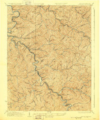
~ Naugatuck WV topo map, 1:62500 scale, 15 X 15 Minute, Historical, 1928
Naugatuck, West Virginia, USGS topographic map dated 1928.
Includes geographic coordinates (latitude and longitude). This topographic map is suitable for hiking, camping, and exploring, or framing it as a wall map.
Printed on-demand using high resolution imagery, on heavy weight and acid free paper, or alternatively on a variety of synthetic materials.
Topos available on paper, Waterproof, Poly, or Tyvek. Usually shipping rolled, unless combined with other folded maps in one order.
- Product Number: USGS-5415682
- Free digital map download (high-resolution, GeoPDF): Naugatuck, West Virginia (file size: 13 MB)
- Map Size: please refer to the dimensions of the GeoPDF map above
- Weight (paper map): ca. 55 grams
- Map Type: POD USGS Topographic Map
- Map Series: HTMC
- Map Verison: Historical
- Cell ID: 58295
- Scan ID: 253743
- Survey Year: 1915
- Datum: NAD
- Map Projection: Polyconic
- Map published by United States Geological Survey
- Map Language: English
- Scanner Resolution: 600 dpi
- Map Cell Name: Navgatuck
- Grid size: 15 X 15 Minute
- Date on map: 1928
- Map Scale: 1:62500
- Geographical region: West Virginia, United States
Neighboring Maps:
All neighboring USGS topo maps are available for sale online at a variety of scales.
Spatial coverage:
Topo map Naugatuck, West Virginia, covers the geographical area associated the following places:
- Hode - West Lovely (historical) - Pilgrim - Greyeagle - Wilsondale - Kermit - Warfield - Parsley Bottom - Selwyn - Upper Tug (historical) - Stepptown - Rapp - Breeden - Missouri Branch - Canterbury - Maher - East Kermit - Webb - Crum - Threeforks - Naugatuck - Spaulding - Lowney - Lovely - Lenore - Millet (historical) - Ajax - McClure - Stonecoal - Doane - Blocton - Tripp - Beauty
- Map Area ID: AREA3837.75-82.5-82.25
- Northwest corner Lat/Long code: USGSNW38-82.5
- Northeast corner Lat/Long code: USGSNE38-82.25
- Southwest corner Lat/Long code: USGSSW37.75-82.5
- Southeast corner Lat/Long code: USGSSE37.75-82.25
- Northern map edge Latitude: 38
- Southern map edge Latitude: 37.75
- Western map edge Longitude: -82.5
- Eastern map edge Longitude: -82.25


