
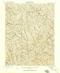
~ Kenna WV topo map, 1:62500 scale, 15 X 15 Minute, Historical, 1906, updated 1959
Kenna, West Virginia, USGS topographic map dated 1906.
Includes geographic coordinates (latitude and longitude). This topographic map is suitable for hiking, camping, and exploring, or framing it as a wall map.
Printed on-demand using high resolution imagery, on heavy weight and acid free paper, or alternatively on a variety of synthetic materials.
Topos available on paper, Waterproof, Poly, or Tyvek. Usually shipping rolled, unless combined with other folded maps in one order.
- Product Number: USGS-5415446
- Free digital map download (high-resolution, GeoPDF): Kenna, West Virginia (file size: 11 MB)
- Map Size: please refer to the dimensions of the GeoPDF map above
- Weight (paper map): ca. 55 grams
- Map Type: POD USGS Topographic Map
- Map Series: HTMC
- Map Verison: Historical
- Cell ID: 56090
- Scan ID: 253613
- Imprint Year: 1959
- Survey Year: 1906
- Datum: NAD27
- Map Projection: Polyconic
- Map published by United States Geological Survey
- Map Language: English
- Scanner Resolution: 600 dpi
- Map Cell Name: Kenna
- Grid size: 15 X 15 Minute
- Date on map: 1906
- Map Scale: 1:62500
- Geographical region: West Virginia, United States
Neighboring Maps:
All neighboring USGS topo maps are available for sale online at a variety of scales.
Spatial coverage:
Topo map Kenna, West Virginia, covers the geographical area associated the following places:
- Winter - Loop - Advent - Cicerone - Island Branch - White Chapel - Liberty - Emma - Kenna - Millertown - Carney (historical) - Given - Statts Mills - Blundon - Young - Mount Tell - Sissonville - Kentuck - Edgar (historical) - Vicars - Goldtown - Plum Orchard - July (historical) - Higby (historical) - Belgrove - Red Knob - Aplin (historical) - Romance - Hicumbottom - Fletcher
- Map Area ID: AREA38.7538.5-81.75-81.5
- Northwest corner Lat/Long code: USGSNW38.75-81.75
- Northeast corner Lat/Long code: USGSNE38.75-81.5
- Southwest corner Lat/Long code: USGSSW38.5-81.75
- Southeast corner Lat/Long code: USGSSE38.5-81.5
- Northern map edge Latitude: 38.75
- Southern map edge Latitude: 38.5
- Western map edge Longitude: -81.75
- Eastern map edge Longitude: -81.5


