
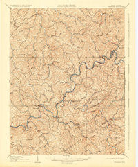
~ Gassaway WV topo map, 1:62500 scale, 15 X 15 Minute, Historical, 1910, updated 1924
Gassaway, West Virginia, USGS topographic map dated 1910.
Includes geographic coordinates (latitude and longitude). This topographic map is suitable for hiking, camping, and exploring, or framing it as a wall map.
Printed on-demand using high resolution imagery, on heavy weight and acid free paper, or alternatively on a variety of synthetic materials.
Topos available on paper, Waterproof, Poly, or Tyvek. Usually shipping rolled, unless combined with other folded maps in one order.
- Product Number: USGS-5415306
- Free digital map download (high-resolution, GeoPDF): Gassaway, West Virginia (file size: 12 MB)
- Map Size: please refer to the dimensions of the GeoPDF map above
- Weight (paper map): ca. 55 grams
- Map Type: POD USGS Topographic Map
- Map Series: HTMC
- Map Verison: Historical
- Cell ID: 54516
- Scan ID: 253537
- Imprint Year: 1924
- Survey Year: 1908
- Datum: NAD
- Map Projection: Polyconic
- Map published by United States Geological Survey
- Map Language: English
- Scanner Resolution: 600 dpi
- Map Cell Name: Gassaway
- Grid size: 15 X 15 Minute
- Date on map: 1910
- Map Scale: 1:62500
- Geographical region: West Virginia, United States
Neighboring Maps:
All neighboring USGS topo maps are available for sale online at a variety of scales.
Spatial coverage:
Topo map Gassaway, West Virginia, covers the geographical area associated the following places:
- Gip - Ira - Davison (historical) - Harrison - Frame Knob (historical) - Twistville (historical) - Clem - Tate - Wilsie - Hallburg - Mark (historical) - Wade - Shadyside - Dessie - Strange Creek - Morris - Tague - Little Otter - Rosedale - Belfont - Rockton - Home - Groves - Meadville (historical) - Clickton (historical) - Canfield - Sleith (historical) - Duck - O'Brion - Dingy - Middle Run - Servia - Glendon - Chapel - Elmira - Herold - Gassaway - Frametown
- Map Area ID: AREA38.7538.5-81-80.75
- Northwest corner Lat/Long code: USGSNW38.75-81
- Northeast corner Lat/Long code: USGSNE38.75-80.75
- Southwest corner Lat/Long code: USGSSW38.5-81
- Southeast corner Lat/Long code: USGSSE38.5-80.75
- Northern map edge Latitude: 38.75
- Southern map edge Latitude: 38.5
- Western map edge Longitude: -81
- Eastern map edge Longitude: -80.75


