
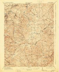
~ Flattop WV topo map, 1:62500 scale, 15 X 15 Minute, Historical, 1914, updated 1930
Flattop, West Virginia, USGS topographic map dated 1914.
Includes geographic coordinates (latitude and longitude). This topographic map is suitable for hiking, camping, and exploring, or framing it as a wall map.
Printed on-demand using high resolution imagery, on heavy weight and acid free paper, or alternatively on a variety of synthetic materials.
Topos available on paper, Waterproof, Poly, or Tyvek. Usually shipping rolled, unless combined with other folded maps in one order.
- Product Number: USGS-5415284
- Free digital map download (high-resolution, GeoPDF): Flattop, West Virginia (file size: 10 MB)
- Map Size: please refer to the dimensions of the GeoPDF map above
- Weight (paper map): ca. 55 grams
- Map Type: POD USGS Topographic Map
- Map Series: HTMC
- Map Verison: Historical
- Cell ID: 54173
- Scan ID: 253524
- Imprint Year: 1930
- Survey Year: 1911
- Datum: NAD
- Map Projection: Polyconic
- Map published by United States Geological Survey
- Map Language: English
- Scanner Resolution: 600 dpi
- Map Cell Name: Flattop
- Grid size: 15 X 15 Minute
- Date on map: 1914
- Map Scale: 1:62500
- Geographical region: West Virginia, United States
Neighboring Maps:
All neighboring USGS topo maps are available for sale online at a variety of scales.
Spatial coverage:
Topo map Flattop, West Virginia, covers the geographical area associated the following places:
- Cedar - Tilden - Battleship - Whitby - Pickshin - Daniels - Beaver - White Oak - Jonben - Lynwinn - Ghent - Glade Springs - Blue Jay 6 - Pemberton - Lego - Mountview - Midway - Josephine - Ellison Ridge - Fireco - Odd - Streeter - Woodpeck - Willibet - Besoco - Take In Hollow - Egeria - Fitzpatrick - Crab Orchard - Sullivan - Winding Gulf - Blue Jay - Cool Ridge - Shady Spring - Affinity - McVey - Princewick - Cherry Creek - Epperly - Dunns - Abney - Coal City - Lillybrook - Flat Top - Spangler Factory (historical)
- Map Area ID: AREA37.7537.5-81.25-81
- Northwest corner Lat/Long code: USGSNW37.75-81.25
- Northeast corner Lat/Long code: USGSNE37.75-81
- Southwest corner Lat/Long code: USGSSW37.5-81.25
- Southeast corner Lat/Long code: USGSSE37.5-81
- Northern map edge Latitude: 37.75
- Southern map edge Latitude: 37.5
- Western map edge Longitude: -81.25
- Eastern map edge Longitude: -81


