
~ Elkins WV topo map, 1:62500 scale, 15 X 15 Minute, Historical, 1909, updated 1942
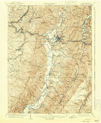
Elkins, West Virginia, USGS topographic map dated 1909.
Includes geographic coordinates (latitude and longitude). This topographic map is suitable for hiking, camping, and exploring, or framing it as a wall map.
Printed on-demand using high resolution imagery, on heavy weight and acid free paper, or alternatively on a variety of synthetic materials.
Topos available on paper, Waterproof, Poly, or Tyvek. Usually shipping rolled, unless combined with other folded maps in one order.
- Product Number: USGS-5415238
- Free digital map download (high-resolution, GeoPDF): Elkins, West Virginia (file size: 11 MB)
- Map Size: please refer to the dimensions of the GeoPDF map above
- Weight (paper map): ca. 55 grams
- Map Type: POD USGS Topographic Map
- Map Series: HTMC
- Map Verison: Historical
- Cell ID: 53820
- Scan ID: 253500
- Imprint Year: 1942
- Survey Year: 1907
- Datum: NAD
- Map Projection: Polyconic
- Map published by United States Geological Survey
- Map Language: English
- Scanner Resolution: 600 dpi
- Map Cell Name: Elkins
- Grid size: 15 X 15 Minute
- Date on map: 1909
- Map Scale: 1:62500
- Geographical region: West Virginia, United States
Neighboring Maps:
All neighboring USGS topo maps are available for sale online at a variety of scales.
Spatial coverage:
Topo map Elkins, West Virginia, covers the geographical area associated the following places:
- Mabie - Gage - Sullivan - Midland - Roaring Creek Junction - Jeff Scotts (historical) - Leadsville - Hazelwood - Cheat Junction - Fairview - Greenbrier Junction - East Dailey - Bruxton - Valley Bend - Fisher (historical) - Elkins - Lonetree (historical) - Coalton - Crystal Springs - Tigheville - Findley (historical) - Beverly - Gilman - Highland Park - Glenmore - Laurel (historical) - Elk River Junction - Dartmoor - Norton - Read - Steiner (historical) - Arnold Hill - Canfield - West Junior - Skidmore (historical) - Beulah - Weaver - Harding - Elkins Junction - Aggregates - Whyte - Dailey - Junior - Leiter (historical) - Harpertown - Lumber (historical)
- Map Area ID: AREA3938.75-80-79.75
- Northwest corner Lat/Long code: USGSNW39-80
- Northeast corner Lat/Long code: USGSNE39-79.75
- Southwest corner Lat/Long code: USGSSW38.75-80
- Southeast corner Lat/Long code: USGSSE38.75-79.75
- Northern map edge Latitude: 39
- Southern map edge Latitude: 38.75
- Western map edge Longitude: -80
- Eastern map edge Longitude: -79.75


