
~ Elk Garden WV topo map, 1:48000 scale, 15 X 15 Minute, Historical, 1920
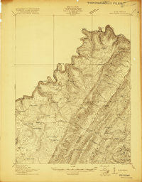
Elk Garden, West Virginia, USGS topographic map dated 1920.
Includes geographic coordinates (latitude and longitude). This topographic map is suitable for hiking, camping, and exploring, or framing it as a wall map.
Printed on-demand using high resolution imagery, on heavy weight and acid free paper, or alternatively on a variety of synthetic materials.
Topos available on paper, Waterproof, Poly, or Tyvek. Usually shipping rolled, unless combined with other folded maps in one order.
- Product Number: USGS-5414826
- Free digital map download (high-resolution, GeoPDF): Elk Garden, West Virginia (file size: 13 MB)
- Map Size: please refer to the dimensions of the GeoPDF map above
- Weight (paper map): ca. 55 grams
- Map Type: POD USGS Topographic Map
- Map Series: HTMC
- Map Verison: Historical
- Cell ID: 53807
- Scan ID: 253220
- Survey Year: 1919
- Datum: Unstated
- Map Projection: Unstated
- Advance: Yes
- Map published by United States Geological Survey
- Keywords: Nonstandard Press Run
- Map Language: English
- Scanner Resolution: 600 dpi
- Map Cell Name: Elk Garden
- Grid size: 15 X 15 Minute
- Date on map: 1920
- Map Scale: 1:48000
- Geographical region: West Virginia, United States
Neighboring Maps:
All neighboring USGS topo maps are available for sale online at a variety of scales.
Spatial coverage:
Topo map Elk Garden, West Virginia, covers the geographical area associated the following places:
- Standard - Hampshire - West Virginia Central Junction - New Creek - Mount Storm - Swanton - Franklin - Strecker - Piedmont - Antioch - Harrison - Windom (historical) - Claysville - Nethkin - Westernport - Luke - Bethel - Bloomington - Elk Garden - West Vindex - Laurel Dale - Oakmont - Crosstown - Hartmansville - Emoryville - Shallmar - Chaffee - Gleason (historical) - East Vindex - Skyline - Mount Pisgah - Beryl - Kitzmiller - Warnocks - Wabash (historical) - Sulphur City - Barnum - Blaine
- Map Area ID: AREA39.539.25-79.25-79
- Northwest corner Lat/Long code: USGSNW39.5-79.25
- Northeast corner Lat/Long code: USGSNE39.5-79
- Southwest corner Lat/Long code: USGSSW39.25-79.25
- Southeast corner Lat/Long code: USGSSE39.25-79
- Northern map edge Latitude: 39.5
- Southern map edge Latitude: 39.25
- Western map edge Longitude: -79.25
- Eastern map edge Longitude: -79


