
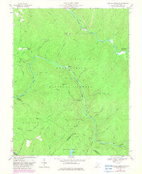
~ Webster Springs SW WV topo map, 1:24000 scale, 7.5 X 7.5 Minute, Historical, 1967, updated 1982
Webster Springs SW, West Virginia, USGS topographic map dated 1967.
Includes geographic coordinates (latitude and longitude). This topographic map is suitable for hiking, camping, and exploring, or framing it as a wall map.
Printed on-demand using high resolution imagery, on heavy weight and acid free paper, or alternatively on a variety of synthetic materials.
Topos available on paper, Waterproof, Poly, or Tyvek. Usually shipping rolled, unless combined with other folded maps in one order.
- Product Number: USGS-5414548
- Free digital map download (high-resolution, GeoPDF): Webster Springs SW, West Virginia (file size: 9 MB)
- Map Size: please refer to the dimensions of the GeoPDF map above
- Weight (paper map): ca. 55 grams
- Map Type: POD USGS Topographic Map
- Map Series: HTMC
- Map Verison: Historical
- Cell ID: 47927
- Scan ID: 701585
- Imprint Year: 1982
- Woodland Tint: Yes
- Photo Revision Year: 1982
- Aerial Photo Year: 1979
- Edit Year: 1982
- Field Check Year: 1967
- Datum: NAD27
- Map Projection: Polyconic
- Map published by United States Geological Survey
- Map Language: English
- Scanner Resolution: 508 dpi
- Map Cell Name: Webster Springs SW
- Grid size: 7.5 X 7.5 Minute
- Date on map: 1967
- Map Scale: 1:24000
- Geographical region: West Virginia, United States
Neighboring Maps:
All neighboring USGS topo maps are available for sale online at a variety of scales.
Spatial coverage:
Topo map Webster Springs SW, West Virginia, covers the geographical area associated the following places:
- Bishop Knob - Bear Run Trail - Dogway Fork - Pheasant Hollow - Aldrich Branch - Baldwin Branch - Briery Knob - Rich Hollow - Goose Hollow - Little Fork - Barrenshe Trail - Cranberry Wildlife Management Area - Bishop Knob Recreation Area - Bee Run Trail - Middle Fork Williams River - Central District - Note Branch - Blacks Chapel Cemetery - Hanging Rock Branch - Little Hacking Run - White Oak Fork - Lick Branch - Lick Branch Trail - Queer Branch - Little Rough Run - Snakeden Mountain - Lower Twin Branch - Laurel Run - Cold Run - Billy Branch - Lick Branch - Spice Run - Cranberry Back Country - Mills Mountain - Big Swag Run - North Cove Run - Three Forks of Williams River - Dogway Camping Shelter - Mills Mountain Church - Little Laurel Branch - Snakeden Trail - Rough Run - Foxtree Run - Laurel Branch - Hanging Rock Trail - Red Oak Lookout Tower - Johnson Run - Hanging Rock - Pleasant Hollow Camping Shelter - Cranberry Campground - Red Oak Knob - Upper Twin Branch - Mill Branch - Summit Lake
- Map Area ID: AREA38.37538.25-80.5-80.375
- Northwest corner Lat/Long code: USGSNW38.375-80.5
- Northeast corner Lat/Long code: USGSNE38.375-80.375
- Southwest corner Lat/Long code: USGSSW38.25-80.5
- Southeast corner Lat/Long code: USGSSE38.25-80.375
- Northern map edge Latitude: 38.375
- Southern map edge Latitude: 38.25
- Western map edge Longitude: -80.5
- Eastern map edge Longitude: -80.375


