
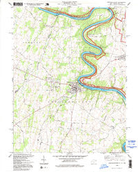
~ Shepherdstown WV topo map, 1:24000 scale, 7.5 X 7.5 Minute, Historical, 1994, updated 1999
Shepherdstown, West Virginia, USGS topographic map dated 1994.
Includes geographic coordinates (latitude and longitude). This topographic map is suitable for hiking, camping, and exploring, or framing it as a wall map.
Printed on-demand using high resolution imagery, on heavy weight and acid free paper, or alternatively on a variety of synthetic materials.
Topos available on paper, Waterproof, Poly, or Tyvek. Usually shipping rolled, unless combined with other folded maps in one order.
- Product Number: USGS-5414234
- Free digital map download (high-resolution, GeoPDF): Shepherdstown, West Virginia (file size: 9 MB)
- Map Size: please refer to the dimensions of the GeoPDF map above
- Weight (paper map): ca. 55 grams
- Map Type: POD USGS Topographic Map
- Map Series: HTMC
- Map Verison: Historical
- Cell ID: 41000
- Scan ID: 701442
- Imprint Year: 1999
- Woodland Tint: Yes
- Photo Inspection Year: 1994
- Aerial Photo Year: 1974
- Datum: NAD27
- Map Projection: Lambert Conformal Conic
- Map published by United States Geological Survey
- Map Language: English
- Scanner Resolution: 508 dpi
- Map Cell Name: Shepherdstown
- Grid size: 7.5 X 7.5 Minute
- Date on map: 1994
- Map Scale: 1:24000
- Geographical region: West Virginia, United States
Neighboring Maps:
All neighboring USGS topo maps are available for sale online at a variety of scales.
Spatial coverage:
Topo map Shepherdstown, West Virginia, covers the geographical area associated the following places:
- Mount Pleasant - Mondell - Foltz (historical) - Mercersville - Confederate Hills - Potomac Valley Farms - Snyders Landing - Potomac Crest - Mechlenberg Heights - Heatherfield - Walpers Cross-Roads - Taylors Landing - Scrabble - Wynkoop Spring - Rose Hill - Morgan Grove - Moler Crossroads - Shepherdstown
- Map Area ID: AREA39.539.375-77.875-77.75
- Northwest corner Lat/Long code: USGSNW39.5-77.875
- Northeast corner Lat/Long code: USGSNE39.5-77.75
- Southwest corner Lat/Long code: USGSSW39.375-77.875
- Southeast corner Lat/Long code: USGSSE39.375-77.75
- Northern map edge Latitude: 39.5
- Southern map edge Latitude: 39.375
- Western map edge Longitude: -77.875
- Eastern map edge Longitude: -77.75


