
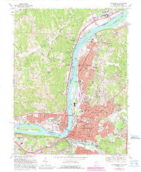
~ Parkersburg WV topo map, 1:24000 scale, 7.5 X 7.5 Minute, Historical, 1969, updated 1989
Parkersburg, West Virginia, USGS topographic map dated 1969.
Includes geographic coordinates (latitude and longitude). This topographic map is suitable for hiking, camping, and exploring, or framing it as a wall map.
Printed on-demand using high resolution imagery, on heavy weight and acid free paper, or alternatively on a variety of synthetic materials.
Topos available on paper, Waterproof, Poly, or Tyvek. Usually shipping rolled, unless combined with other folded maps in one order.
- Product Number: USGS-5413822
- Free digital map download (high-resolution, GeoPDF): Parkersburg, West Virginia (file size: 15 MB)
- Map Size: please refer to the dimensions of the GeoPDF map above
- Weight (paper map): ca. 55 grams
- Map Type: POD USGS Topographic Map
- Map Series: HTMC
- Map Verison: Historical
- Cell ID: 34260
- Scan ID: 701219
- Imprint Year: 1989
- Woodland Tint: Yes
- Photo Revision Year: 1989
- Aerial Photo Year: 1987
- Edit Year: 1989
- Field Check Year: 1969
- Datum: NAD27
- Map Projection: Polyconic
- Map published by United States Geological Survey
- Map Language: English
- Scanner Resolution: 508 dpi
- Map Cell Name: Parkersburg
- Grid size: 7.5 X 7.5 Minute
- Date on map: 1969
- Map Scale: 1:24000
- Geographical region: West Virginia, United States
Neighboring Maps:
All neighboring USGS topo maps are available for sale online at a variety of scales.
Spatial coverage:
Topo map Parkersburg, West Virginia, covers the geographical area associated the following places:
- North Hills - Vienna - Woodland Heights - Denim Shack Mobile Home Park - Georges Trailer Park - Riverside - W D Miller Trailer Park - Beechwood - Mercers Mobile Home Park - Sunset Heights - Parkersburg - Rockland - Fairway Acres - Forest Hills - Marrtown - North Parkersburg - Briscoe - Somervilla - Fairview Heights - Blennerhassett Heights - Constitution - Newport - Glenbrook - Morris Mobile Home Park (historical) - Blennerhassett Island View Addition - Dupont Manor - Lauckport - Belpre - Worthington Meadows - Pioneer Mobile Home Park - Summit - Broadmoor Addition - Central - Woodland Park - Sunrise - Melrose Addition - Barclay Acres - Evandale Terrace - Tavennersville - Riverview - Wellsley - Boaz - Blennerhassett View
- Map Area ID: AREA39.37539.25-81.625-81.5
- Northwest corner Lat/Long code: USGSNW39.375-81.625
- Northeast corner Lat/Long code: USGSNE39.375-81.5
- Southwest corner Lat/Long code: USGSSW39.25-81.625
- Southeast corner Lat/Long code: USGSSE39.25-81.5
- Northern map edge Latitude: 39.375
- Southern map edge Latitude: 39.25
- Western map edge Longitude: -81.625
- Eastern map edge Longitude: -81.5


