
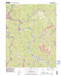
~ Logan WV topo map, 1:24000 scale, 7.5 X 7.5 Minute, Historical, 1996, updated 2002
Logan, West Virginia, USGS topographic map dated 1996.
Includes geographic coordinates (latitude and longitude). This topographic map is suitable for hiking, camping, and exploring, or framing it as a wall map.
Printed on-demand using high resolution imagery, on heavy weight and acid free paper, or alternatively on a variety of synthetic materials.
Topos available on paper, Waterproof, Poly, or Tyvek. Usually shipping rolled, unless combined with other folded maps in one order.
- Product Number: USGS-5413300
- Free digital map download (high-resolution, GeoPDF): Logan, West Virginia (file size: 15 MB)
- Map Size: please refer to the dimensions of the GeoPDF map above
- Weight (paper map): ca. 55 grams
- Map Type: POD USGS Topographic Map
- Map Series: HTMC
- Map Verison: Historical
- Cell ID: 26258
- Scan ID: 700943
- Imprint Year: 2002
- Woodland Tint: Yes
- Aerial Photo Year: 1996
- Datum: NAD83
- Map Projection: Universal Transverse Mercator
- Map published by United States Geological Survey
- Map Language: English
- Scanner Resolution: 508 dpi
- Map Cell Name: Logan
- Grid size: 7.5 X 7.5 Minute
- Date on map: 1996
- Map Scale: 1:24000
- Geographical region: West Virginia, United States
Neighboring Maps:
All neighboring USGS topo maps are available for sale online at a variety of scales.
Spatial coverage:
Topo map Logan, West Virginia, covers the geographical area associated the following places:
- Argyle - Orville - Aracoma - Omar - Wilkinson - Ethel - Rita - Earling - Lyburn - Micco - Dog Patch - Sunbeam - Mellville - Rum Junction - Chambers - Buskirk Addition - McConnell - Red Campbell - Dehue - Switzer - Wanda - Freeze Fork - Hutchinson - Fort Branch - Deskin Addition - Chauncey - West Logan - Neibert - Rossmore - Logan - Taplin - Monaville - Dabney - Hetzel - Peach Creek - Stollings
- Map Area ID: AREA37.87537.75-82-81.875
- Northwest corner Lat/Long code: USGSNW37.875-82
- Northeast corner Lat/Long code: USGSNE37.875-81.875
- Southwest corner Lat/Long code: USGSSW37.75-82
- Southeast corner Lat/Long code: USGSSE37.75-81.875
- Northern map edge Latitude: 37.875
- Southern map edge Latitude: 37.75
- Western map edge Longitude: -82
- Eastern map edge Longitude: -81.875


