
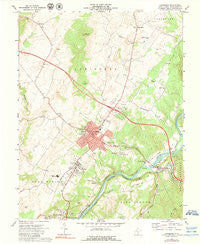
~ Lewisburg WV topo map, 1:24000 scale, 7.5 X 7.5 Minute, Historical, 1972, updated 1979
Lewisburg, West Virginia, USGS topographic map dated 1972.
Includes geographic coordinates (latitude and longitude). This topographic map is suitable for hiking, camping, and exploring, or framing it as a wall map.
Printed on-demand using high resolution imagery, on heavy weight and acid free paper, or alternatively on a variety of synthetic materials.
Topos available on paper, Waterproof, Poly, or Tyvek. Usually shipping rolled, unless combined with other folded maps in one order.
- Product Number: USGS-5413262
- Free digital map download (high-resolution, GeoPDF): Lewisburg, West Virginia (file size: 10 MB)
- Map Size: please refer to the dimensions of the GeoPDF map above
- Weight (paper map): ca. 55 grams
- Map Type: POD USGS Topographic Map
- Map Series: HTMC
- Map Verison: Historical
- Cell ID: 25559
- Scan ID: 700925
- Imprint Year: 1979
- Woodland Tint: Yes
- Photo Inspection Year: 1979
- Aerial Photo Year: 1970
- Field Check Year: 1972
- Datum: NAD27
- Map Projection: Lambert Conformal Conic
- Map published by United States Geological Survey
- Map Language: English
- Scanner Resolution: 508 dpi
- Map Cell Name: Lewisburg
- Grid size: 7.5 X 7.5 Minute
- Date on map: 1972
- Map Scale: 1:24000
- Geographical region: West Virginia, United States
Neighboring Maps:
All neighboring USGS topo maps are available for sale online at a variety of scales.
Spatial coverage:
Topo map Lewisburg, West Virginia, covers the geographical area associated the following places:
- Morlunda - Mountain View Estates - Buckingham Acres - Underwood Estates - Richlands - Fairlea - Caldwell - Rolling Hills - Lewisburg - Whitcomb (historical) - Dogwood Heights - Walnut Hills - Teaberry - Fair Oaks Trailer Park - Maxwelton - Crowfields - Cedar Knoll Trailer Park - Fuller Trailer Park - North Caldwell
- Map Area ID: AREA37.87537.75-80.5-80.375
- Northwest corner Lat/Long code: USGSNW37.875-80.5
- Northeast corner Lat/Long code: USGSNE37.875-80.375
- Southwest corner Lat/Long code: USGSSW37.75-80.5
- Southeast corner Lat/Long code: USGSSE37.75-80.375
- Northern map edge Latitude: 37.875
- Southern map edge Latitude: 37.75
- Western map edge Longitude: -80.5
- Eastern map edge Longitude: -80.375


