
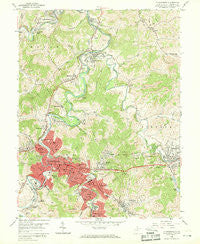
~ Clarksburg WV topo map, 1:24000 scale, 7.5 X 7.5 Minute, Historical, 1958, updated 1969
Clarksburg, West Virginia, USGS topographic map dated 1958.
Includes geographic coordinates (latitude and longitude). This topographic map is suitable for hiking, camping, and exploring, or framing it as a wall map.
Printed on-demand using high resolution imagery, on heavy weight and acid free paper, or alternatively on a variety of synthetic materials.
Topos available on paper, Waterproof, Poly, or Tyvek. Usually shipping rolled, unless combined with other folded maps in one order.
- Product Number: USGS-5412560
- Free digital map download (high-resolution, GeoPDF): Clarksburg, West Virginia (file size: 16 MB)
- Map Size: please refer to the dimensions of the GeoPDF map above
- Weight (paper map): ca. 55 grams
- Map Type: POD USGS Topographic Map
- Map Series: HTMC
- Map Verison: Historical
- Cell ID: 8935
- Scan ID: 252953
- Imprint Year: 1969
- Woodland Tint: Yes
- Aerial Photo Year: 1955
- Field Check Year: 1958
- Datum: NAD27
- Map Projection: Polyconic
- Map published by United States Geological Survey
- Map Language: English
- Scanner Resolution: 600 dpi
- Map Cell Name: Clarksburg
- Grid size: 7.5 X 7.5 Minute
- Date on map: 1958
- Map Scale: 1:24000
- Geographical region: West Virginia, United States
Neighboring Maps:
All neighboring USGS topo maps are available for sale online at a variety of scales.
Spatial coverage:
Topo map Clarksburg, West Virginia, covers the geographical area associated the following places:
- Arlington - Adamston - Erie - Clarksburg - Lumberport - Gore - Cook Mine - Stealey - North View - Bridgeport - Custer Addition - Arbutus Park - Glen Falls - Montpelier - Laura Lee Mine - Dawmont - Edgewood - Nutter Fort - Broad Oaks - Chestnut Hills - East View - Farnum - Stonewood - Despard - Saltwell - Anmoore - Glen Elk - Hepzibah - Cambria - Spelter - Industrial - Lodgeville - Courtright - Summit Park - Meadowbrook - Gypsy
- Map Area ID: AREA39.37539.25-80.375-80.25
- Northwest corner Lat/Long code: USGSNW39.375-80.375
- Northeast corner Lat/Long code: USGSNE39.375-80.25
- Southwest corner Lat/Long code: USGSSW39.25-80.375
- Southeast corner Lat/Long code: USGSSE39.25-80.25
- Northern map edge Latitude: 39.375
- Southern map edge Latitude: 39.25
- Western map edge Longitude: -80.375
- Eastern map edge Longitude: -80.25


