
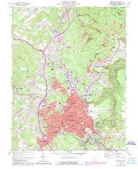
~ Beckley WV topo map, 1:24000 scale, 7.5 X 7.5 Minute, Historical, 1969, updated 1989
Beckley, West Virginia, USGS topographic map dated 1969.
Includes geographic coordinates (latitude and longitude). This topographic map is suitable for hiking, camping, and exploring, or framing it as a wall map.
Printed on-demand using high resolution imagery, on heavy weight and acid free paper, or alternatively on a variety of synthetic materials.
Topos available on paper, Waterproof, Poly, or Tyvek. Usually shipping rolled, unless combined with other folded maps in one order.
- Product Number: USGS-5412154
- Free digital map download (high-resolution, GeoPDF): Beckley, West Virginia (file size: 13 MB)
- Map Size: please refer to the dimensions of the GeoPDF map above
- Weight (paper map): ca. 55 grams
- Map Type: POD USGS Topographic Map
- Map Series: HTMC
- Map Verison: Historical
- Cell ID: 2985
- Scan ID: 700362
- Imprint Year: 1989
- Woodland Tint: Yes
- Photo Revision Year: 1989
- Aerial Photo Year: 1986
- Edit Year: 1989
- Field Check Year: 1969
- Datum: NAD27
- Map Projection: Polyconic
- Map published by United States Geological Survey
- Map Language: English
- Scanner Resolution: 508 dpi
- Map Cell Name: Beckley
- Grid size: 7.5 X 7.5 Minute
- Date on map: 1969
- Map Scale: 1:24000
- Geographical region: West Virginia, United States
Neighboring Maps:
All neighboring USGS topo maps are available for sale online at a variety of scales.
Spatial coverage:
Topo map Beckley, West Virginia, covers the geographical area associated the following places:
- Bradley - Maple Fork - East Beckley - Morgan Hills - Skelton - Stonewall (historical) - Stanaford - Whorley (historical) - Tamroy (historical) - Pinepoca (historical) - Old Mill Village - Oswald (historical) - Beckley - James Crest Farms - Warden - Mount Tabor - Mabscott - Beckley Junction - Lanark - Raleigh - Johnstown - Piney View - Wickham - Cranberry - Sprague - Glen Morgan - Rodes (historical) - Harper Heights - Prosperity - White Stick (historical) - Sylvia (historical) - MacArthur - Pine Hills - Riley - Cabell - Dry Hill
- Map Area ID: AREA37.87537.75-81.25-81.125
- Northwest corner Lat/Long code: USGSNW37.875-81.25
- Northeast corner Lat/Long code: USGSNE37.875-81.125
- Southwest corner Lat/Long code: USGSSW37.75-81.25
- Southeast corner Lat/Long code: USGSSE37.75-81.125
- Northern map edge Latitude: 37.875
- Southern map edge Latitude: 37.75
- Western map edge Longitude: -81.25
- Eastern map edge Longitude: -81.125


