
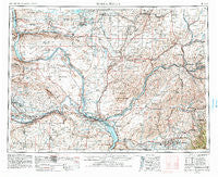
~ Walla Walla WA topo map, 1:250000 scale, 1 X 2 Degree, Historical, 1953, updated 1983
Walla Walla, Washington, USGS topographic map dated 1953.
Includes geographic coordinates (latitude and longitude). This topographic map is suitable for hiking, camping, and exploring, or framing it as a wall map.
Printed on-demand using high resolution imagery, on heavy weight and acid free paper, or alternatively on a variety of synthetic materials.
Topos available on paper, Waterproof, Poly, or Tyvek. Usually shipping rolled, unless combined with other folded maps in one order.
- Product Number: USGS-5411556
- Free digital map download (high-resolution, GeoPDF): Walla Walla, Washington (file size: 21 MB)
- Map Size: please refer to the dimensions of the GeoPDF map above
- Weight (paper map): ca. 55 grams
- Map Type: POD USGS Topographic Map
- Map Series: HTMC
- Map Verison: Historical
- Cell ID: 69085
- Scan ID: 244515
- Imprint Year: 1983
- Woodland Tint: Yes
- Aerial Photo Year: 1980
- Edit Year: 1981
- Field Check Year: 1953
- Datum: NAD27
- Map Projection: Transverse Mercator
- Map published by United States Geological Survey
- Map Language: English
- Scanner Resolution: 600 dpi
- Map Cell Name: Walla Walla
- Grid size: 1 X 2 Degree
- Date on map: 1953
- Map Scale: 1:250000
- Geographical region: Washington, United States
Neighboring Maps:
All neighboring USGS topo maps are available for sale online at a variety of scales.
Spatial coverage:
Topo map Walla Walla, Washington, covers the geographical area associated the following places:
- Powers - Minnick - Bemis - Willa - Russell - Richland Y - Harvey - Kooskooskie - Attalia - Sulphur - Zangar Junction - Glade - Climax - Myers - Roxboro - Richland - White Bluffs - Mesa - Pizarro - Langdon - Curry - Ethel - Magallon - Huntsville - Hooper - Horse Heaven - Jericho - Koren - Highland - Kahlotus - Welland - Othello - Smyrna - Whitstran - Blackrock (historical) - Hatch - Levey - Paddock - Walker - Nancy - Benton City - Ennis - Island View - Mathews Corner - Baker-Langdon - Garrett - Kibler - Eureka - Dixie - Schwana - Byron - Rulo - Waitsburg - Fletcher - Clyde - Martindale - Ruxby - Washtucna - Grandview - Yellepit - Blacks Corner - Port of Kennewick - Gilliam - Long - Wahluke - Davin - Five Corners - Mattawa - Pearl - Estes - Sheffler - Audrey - Adkins - Tompkins - Kiona - South Highlands - Lind - Ralston - Coppei - Hadley - Shano - Chew - Thavis - Waiilatpo (historical) - Finley - Riverview - McAdam - May Junction - Walla Walla - Hanford - Port Kelley - Burr - Ruth - Windust - Hedges - Bettie - Varna - Sapolil - Schlomer - Tracy
- Map Area ID: AREA4746-120-118
- Northwest corner Lat/Long code: USGSNW47-120
- Northeast corner Lat/Long code: USGSNE47-118
- Southwest corner Lat/Long code: USGSSW46-120
- Southeast corner Lat/Long code: USGSSE46-118
- Northern map edge Latitude: 47
- Southern map edge Latitude: 46
- Western map edge Longitude: -120
- Eastern map edge Longitude: -118


