
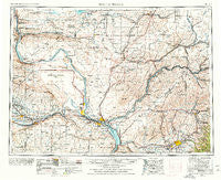
~ Walla Walla WA topo map, 1:250000 scale, 1 X 2 Degree, Historical, 1953, updated 1978
Walla Walla, Washington, USGS topographic map dated 1953.
Includes geographic coordinates (latitude and longitude). This topographic map is suitable for hiking, camping, and exploring, or framing it as a wall map.
Printed on-demand using high resolution imagery, on heavy weight and acid free paper, or alternatively on a variety of synthetic materials.
Topos available on paper, Waterproof, Poly, or Tyvek. Usually shipping rolled, unless combined with other folded maps in one order.
- Product Number: USGS-5411554
- Free digital map download (high-resolution, GeoPDF): Walla Walla, Washington (file size: 20 MB)
- Map Size: please refer to the dimensions of the GeoPDF map above
- Weight (paper map): ca. 55 grams
- Map Type: POD USGS Topographic Map
- Map Series: HTMC
- Map Verison: Historical
- Cell ID: 69085
- Scan ID: 244507
- Imprint Year: 1978
- Woodland Tint: Yes
- Edit Year: 1963
- Field Check Year: 1953
- Datum: Unstated
- Map Projection: Transverse Mercator
- Map published by United States Geological Survey
- Map Language: English
- Scanner Resolution: 600 dpi
- Map Cell Name: Walla Walla
- Grid size: 1 X 2 Degree
- Date on map: 1953
- Map Scale: 1:250000
- Geographical region: Washington, United States
Neighboring Maps:
All neighboring USGS topo maps are available for sale online at a variety of scales.
Spatial coverage:
Topo map Walla Walla, Washington, covers the geographical area associated the following places:
- Beverly Junction - Page - Sheffler - Pasco - West Richland - Whitman - Adkins - Ruth - Sudbury - Hunt - Lowden - Willa - Wallula Junction - Ralston - Bemis - Richland - Thavis - Eureka - Novara - West Pasco - Thomas - Starbuck - Stateline - Mathews Corner - Gibbon - Bettie - Pierce - Lichty - Farrington - Mack - Tracy - Byron - Buroker - Slater - Walker - Givens Corner - Vista - Island View - Tompkins - Dixie - Villard Junction - Kennewick - Ankeny - College Place - Huntsville - Levering - Edwards - Wacota - Kibler - Perry - Estes - Paddock - Whitstran - Riparia - Hadley - Mesa - Connell - Benge - Thiel - Geneva Junction - Clyde - Attalia - Mabton - Apricot - Scott - Waiilatpo (historical) - West Highlands - Chaffee - Richland Junction - Gordon - Bruce - Ginger - Pearl - Grange City (historical) - Harbert - Lee - Desert Aire - Susie - Robinson - North Prosser - Calhounville - Hatch - Humorist - Beverly - Matthew - Langdon - Hooper - Myers - Ennis - Relief - Davin - Redd - Royal City - Eltopia - Providence - Prosser - White Bluffs - Levey - Vantage - Kiona
- Map Area ID: AREA4746-120-118
- Northwest corner Lat/Long code: USGSNW47-120
- Northeast corner Lat/Long code: USGSNE47-118
- Southwest corner Lat/Long code: USGSSW46-120
- Southeast corner Lat/Long code: USGSSE46-118
- Northern map edge Latitude: 47
- Southern map edge Latitude: 46
- Western map edge Longitude: -120
- Eastern map edge Longitude: -118


