
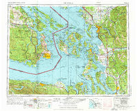
~ Victoria WA topo map, 1:250000 scale, 1 X 2 Degree, Historical, 1957, updated 1976
Victoria, Washington, USGS topographic map dated 1957.
Includes geographic coordinates (latitude and longitude). This topographic map is suitable for hiking, camping, and exploring, or framing it as a wall map.
Printed on-demand using high resolution imagery, on heavy weight and acid free paper, or alternatively on a variety of synthetic materials.
Topos available on paper, Waterproof, Poly, or Tyvek. Usually shipping rolled, unless combined with other folded maps in one order.
- Product Number: USGS-5411546
- Free digital map download (high-resolution, GeoPDF): Victoria, Washington (file size: 24 MB)
- Map Size: please refer to the dimensions of the GeoPDF map above
- Weight (paper map): ca. 55 grams
- Map Type: POD USGS Topographic Map
- Map Series: HTMC
- Map Verison: Historical
- Cell ID: 75040
- Scan ID: 244479
- Imprint Year: 1976
- Woodland Tint: Yes
- Aerial Photo Year: 1973
- Edit Year: 1974
- Field Check Year: 1957
- Datum: Unstated
- Map Projection: Transverse Mercator
- Map published by: Military, Other
- Map Language: English
- Scanner Resolution: 600 dpi
- Map Cell Name: Victoria
- Grid size: 1 X 2 Degree
- Date on map: 1957
- Map Scale: 1:250000
- Geographical region: Washington, United States
Neighboring Maps:
All neighboring USGS topo maps are available for sale online at a variety of scales.
Spatial coverage:
Topo map Victoria, Washington, covers the geographical area associated the following places:
- Prevost - Baby Island Heights - Marysville - Kendall - Victor - Edgecomb - Maple Grove Beach - Mount Vernon - Bow - Lummi - Dungeness - English - Mountain View Mobile Park - Gibraltar - Pebble Beach - Sunset Terrace - Lynden - Ramapo - Northwood - Wahl - Oaks Mobile Home Park - Point Roberts - Prairie Center - Port Discovery - Mobile Manor - Decatur - Portal Creek Mobile Home Park - Keystone - Midway Gardens Mobile Park - Juniper Mobile Estates - West Shore - Dewey - Chuckanut Village - Edgewater Resort and Trailer Park - Cedarville - Day Creek - Equality - Atlanta (historical) - Dean Manor - Warm Beach Estates Mobile Home Park - Chimacum - Swantown - Shadow - Laurel - Pine Street Mobile Home Park - Rena - Chuckanut Junction - Madrona Beach - Burlington - Goshen - Woodmans - Port Arthur (historical) - Urban - Fairhaven - Lochsloy - Hidden Glen Mobile Home Park - Sunset - King Hill - Parkview - McGees (historical) - Kickerville - Hawkeye Mobile Home Park - Similk Beach - Fidalgo - Geneva - Irondale - Lake Goodwin - Sunny Shores - Arlington Heights - Milltown - Colonial Mobile Home Park - San de Fuca - Evergreen Mobile Home Park - Cokedale - Tulalip - Forest Ridge - Bryant - Lawrence - Big Lake - Warm Beach - Green Acres Mobile Estates - Columbia - Port Crescent - Belfast - Cedar Grove Mobile Home Park - Waldron - Welcome - Lake Stevens - Lakeway Mobile Estates - Mirror Lake - Fort Knox Mobile Home Park - Bel Air Village Trailer Court - Wagon Wheel Mobile Home Park - Little Oklahoma - Lower Elwha - McMurray - Burlington Mobile Park - Carlsborg - Nelson Mobile Home Park - Swinomish Village
- Map Area ID: AREA4948-124-122
- Northwest corner Lat/Long code: USGSNW49-124
- Northeast corner Lat/Long code: USGSNE49-122
- Southwest corner Lat/Long code: USGSSW48-124
- Southeast corner Lat/Long code: USGSSE48-122
- Northern map edge Latitude: 49
- Southern map edge Latitude: 48
- Western map edge Longitude: -124
- Eastern map edge Longitude: -122


