
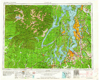
~ Seattle WA topo map, 1:250000 scale, 1 X 2 Degree, Historical, 1962
Seattle, Washington, USGS topographic map dated 1962.
Includes geographic coordinates (latitude and longitude). This topographic map is suitable for hiking, camping, and exploring, or framing it as a wall map.
Printed on-demand using high resolution imagery, on heavy weight and acid free paper, or alternatively on a variety of synthetic materials.
Topos available on paper, Waterproof, Poly, or Tyvek. Usually shipping rolled, unless combined with other folded maps in one order.
- Product Number: USGS-5411528
- Free digital map download (high-resolution, GeoPDF): Seattle, Washington (file size: 23 MB)
- Map Size: please refer to the dimensions of the GeoPDF map above
- Weight (paper map): ca. 55 grams
- Map Type: POD USGS Topographic Map
- Map Series: HTMC
- Map Verison: Historical
- Cell ID: 72248
- Scan ID: 243644
- Woodland Tint: Yes
- Field Check Year: 1958
- Datum: Unstated
- Map Projection: Transverse Mercator
- Map published by United States Army Corps of Engineers
- Map published by United States Army
- Map Language: English
- Scanner Resolution: 600 dpi
- Map Cell Name: Seattle
- Grid size: 1 X 2 Degree
- Date on map: 1962
- Map Scale: 1:250000
- Geographical region: Washington, United States
Neighboring Maps:
All neighboring USGS topo maps are available for sale online at a variety of scales.
Spatial coverage:
Topo map Seattle, Washington, covers the geographical area associated the following places:
- Port Ludlow - Latona - Lakewood Mobile Home Park - Johnson Landing - Camp Discovery - Sheridan - Northwest Mobile Home Park - Martha Lake - Berrydale - Lakeland - Picnic Point - Thomas - Courtyard Mobile Home Park - Cascade Vista Mobile Estates - Harvest Gate Mobile Home Park - Oak Acres Mobile Home Park - Des Moines - Pinecrest Mobile Home Park - South Seattle - Wildwood Mobile Home Estates - Moorland - Medina - Rocky Point Mobile Home Park - Crossroads - Whispering Firs Mobile Park - Columbia - White - Amanda Park - Berry Lake Manor Mobile Home Park - Sunbeach - Little Hoquiam - Adelaide - Vue Mobile Home Park - Town and Country Villa Mobile Home Park - Westward Mobile Park - Penny Lynn Mobile Home Park - Fairfield Estates Mobile Home Park - Edgewater Park - Canterwood - Mats Mats - Hazelwood - Friendly Village of Redmond Mobile Home Park - Suquamish - Bella Mobile Home Park - Clover Creek Trailer Court - Bryn Mawr - Gregory Heights - Canyon Glen Mobile Home Park - Waterman - Trailer Lane Mobile Park - Shady Haven Mobile Home Park - Vashon - North City - Sherwood Village Mobile Home Park - Madison Park - Covington - Everett Junction - Northlake Mobile Home Park - Inglesea - Robinswood - Newport - Allynview Mobile Park - Key Center - Jackson Park - Viking Mobile Home Court - Elizan Beach - West Lake Sammamish - Newaukum - Bow Lake Residential Mobile Home Community - Town and Country Mobile Manor - Martell Mobile Manor - Shore Acres - Larimers Corner - Spanaway Mobile Village - Kitsap West Mobile Home Court - McMillin - Evergreen Mobile Estates - Wallingford - Delridge - High Valley - Paradise Mobile Home Park - Sunrise Beach - Firwood Mobile Home Park - Kitsap Lake Mobile Home Park - Shilo Mobile Home Park - Summit - Pines Mobile Home Park - Mirror Lake - Shoreline - McGilvara - Bee - Highlands Park - Black Diamond - Ronald - Treemont - Lake Stickney - Chinook Mobile Home Park - Cascade Junction - Riverbend Mobile Home Park - Brockdale
- Map Area ID: AREA4847-124-122
- Northwest corner Lat/Long code: USGSNW48-124
- Northeast corner Lat/Long code: USGSNE48-122
- Southwest corner Lat/Long code: USGSSW47-124
- Southeast corner Lat/Long code: USGSSE47-122
- Northern map edge Latitude: 48
- Southern map edge Latitude: 47
- Western map edge Longitude: -124
- Eastern map edge Longitude: -122


