
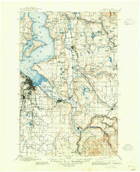
~ Tacoma WA topo map, 1:125000 scale, 30 X 30 Minute, Historical, 1900, updated 1945
Tacoma, Washington, USGS topographic map dated 1900.
Includes geographic coordinates (latitude and longitude). This topographic map is suitable for hiking, camping, and exploring, or framing it as a wall map.
Printed on-demand using high resolution imagery, on heavy weight and acid free paper, or alternatively on a variety of synthetic materials.
Topos available on paper, Waterproof, Poly, or Tyvek. Usually shipping rolled, unless combined with other folded maps in one order.
- Product Number: USGS-5411450
- Free digital map download (high-resolution, GeoPDF): Tacoma, Washington (file size: 9 MB)
- Map Size: please refer to the dimensions of the GeoPDF map above
- Weight (paper map): ca. 55 grams
- Map Type: POD USGS Topographic Map
- Map Series: HTMC
- Map Verison: Historical
- Cell ID: 66747
- Scan ID: 244186
- Imprint Year: 1945
- Survey Year: 1895
- Datum: Unstated
- Map Projection: Polyconic
- Map published by United States Geological Survey
- Map Language: English
- Scanner Resolution: 600 dpi
- Map Cell Name: Tacoma
- Grid size: 30 X 30 Minute
- Date on map: 1900
- Map Scale: 1:125000
- Geographical region: Washington, United States
Neighboring Maps:
All neighboring USGS topo maps are available for sale online at a variety of scales.
Spatial coverage:
Topo map Tacoma, Washington, covers the geographical area associated the following places:
- Bethel Park - Vue Mobile Home Park - Glendale Mobile Home Park - Wonderland Mobile Homes - Dieringer - Cascade - Mirror Lake - May Valley Manor Mobile Home Park - Tacoma - Whispering Firs Mobile Home Park - Summit - Vermontville (historical) - Laurelwood Valley Mobile Home Park - Rosehilla - Croker - View Crest Mobile Manor - Rhododendron Mobile Home Park - Fife Heights - Cowley - Diru Mobile Home Park - Spanaway - Twin Oaks Mobile Home Park - Crystal Spring Mobile Home Estates - Cherokee Bay Park - Tiger Mountain Mobile Home Park - Fairlane Terrace Mobile Home Park - Gregory Heights - Country West Mobile Home Park - Adelaide - Henrys - Summerville Estates Mobile Home Park - Majestic Mobile Manor - Auburn Mobile Park - Tanwax - Canyon View Mobile Home Park - Alderton - Spaids Unique Manor and Estates Mobile Home Park - Killarney Woods Mobile Home Park - Renton - Rio Verde Mobile Estates - Country Mobile Estates - O'Brien - Cascade Mobile Villa - Meeker - Don Juan Mobile Home Park - Riverside Villa Mobile Home Park - Loveland Mobile Estates - Mountplains Rainier Mobile Home Park - Fife - Greenwood Mobile Home Park - Tyee Valley Mobile Manor - Buenna - Des Moines - Bonney Lake - Cedar Grove Mobile Home Park - Soos Creek Mobile Home Estates - Edgewood - Atkinson - Brookdale - Old Tacoma - Allentown - Rocky Ridge - Sunnyside Mobile Home Park - Pine Terrace Mobile Home Park - The River Mobile Estates - Arcadia - Empire View Mobile Home Park - White River Estate Mobile Home Park - Parklane Mobile Estates - Parkland Mobile Village - Vantage Glen Mobile Home Park - Lakota - Skylark Village Mobile Home Park - Skyway - Portage - Fern Hill - Three Ponds Mobile Home Park - Little Cedars Mobile Home Park - Tacoma Country Estates Mobile Home Park - Allison - Thomas - Park Place Estates Manufactured Home Park - Fairfax - Central Valley Mobile Home Park - Burton - Morganville - Valley Mobile Manor - Shadow Pines Mobile Estates - Larchmont - Dorre Don - Woodmont Beach - Fruitland Gardens Mobile Home Park - Hillsdale - Auburn Manor Community Mobile Home Park - Manitou - Circle K Mobile Home Park - Double A Mobile Manor - Maury - Excelsior - Monta Vista
- Map Area ID: AREA47.547-122.5-122
- Northwest corner Lat/Long code: USGSNW47.5-122.5
- Northeast corner Lat/Long code: USGSNE47.5-122
- Southwest corner Lat/Long code: USGSSW47-122.5
- Southeast corner Lat/Long code: USGSSE47-122
- Northern map edge Latitude: 47.5
- Southern map edge Latitude: 47
- Western map edge Longitude: -122.5
- Eastern map edge Longitude: -122


