
~ Sultan WA topo map, 1:125000 scale, 30 X 30 Minute, Historical, 1921
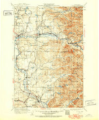
Sultan, Washington, USGS topographic map dated 1921.
Includes geographic coordinates (latitude and longitude). This topographic map is suitable for hiking, camping, and exploring, or framing it as a wall map.
Printed on-demand using high resolution imagery, on heavy weight and acid free paper, or alternatively on a variety of synthetic materials.
Topos available on paper, Waterproof, Poly, or Tyvek. Usually shipping rolled, unless combined with other folded maps in one order.
- Product Number: USGS-5411418
- Free digital map download (high-resolution, GeoPDF): Sultan, Washington (file size: 11 MB)
- Map Size: please refer to the dimensions of the GeoPDF map above
- Weight (paper map): ca. 55 grams
- Map Type: POD USGS Topographic Map
- Map Series: HTMC
- Map Verison: Historical
- Cell ID: 66724
- Scan ID: 244095
- Survey Year: 1921
- Datum: NAD
- Map Projection: Polyconic
- Map published by United States Geological Survey
- Map Language: English
- Scanner Resolution: 600 dpi
- Map Cell Name: Sultan
- Grid size: 30 X 30 Minute
- Date on map: 1921
- Map Scale: 1:125000
- Geographical region: Washington, United States
Neighboring Maps:
All neighboring USGS topo maps are available for sale online at a variety of scales.
Spatial coverage:
Topo map Sultan, Washington, covers the geographical area associated the following places:
- Junction - Alpine Mobile Manor - Upper Preston - Snoqualmie Falls - Cherry Hill Estates Mobile Home Park - Forest Glade - Depot Village Mobile Home Park - Carnation - West Mobile Park - Ernies Grove - Ames Lake - Novelty - May Creek - Preston - Monroe - High Rock - High Point - Startup - Reiter - Wallace River Mobile Home Park - Fall City Mobile Park - Fall City - Pearson Eddy - Halford - Monroe Junction - Stuart - Duvall - Timberline Mobile Home Village - Carnation Mobile Haven - Tokul - Wagner - Index - Monroe Mobile Home Park - Pleasant Hill - Alpine Meadows Mobile Home Park - Nordrum (historical) - Lake Roesiger - Snoqualmie - Stillwater - McDaniels Mobile Village - Lake Marcel - Sultan - Spring Glen - Ellisville - Duvall Highland Mobile Home Park - Gold Bar - Woods Creek - North Sultan - Spring Glen Mobile Home Park
- Map Area ID: AREA4847.5-122-121.5
- Northwest corner Lat/Long code: USGSNW48-122
- Northeast corner Lat/Long code: USGSNE48-121.5
- Southwest corner Lat/Long code: USGSSW47.5-122
- Southeast corner Lat/Long code: USGSSE47.5-121.5
- Northern map edge Latitude: 48
- Southern map edge Latitude: 47.5
- Western map edge Longitude: -122
- Eastern map edge Longitude: -121.5


