
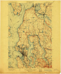
~ Snohomish WA topo map, 1:125000 scale, 30 X 30 Minute, Historical, 1897, updated 1912
Snohomish, Washington, USGS topographic map dated 1897.
Includes geographic coordinates (latitude and longitude). This topographic map is suitable for hiking, camping, and exploring, or framing it as a wall map.
Printed on-demand using high resolution imagery, on heavy weight and acid free paper, or alternatively on a variety of synthetic materials.
Topos available on paper, Waterproof, Poly, or Tyvek. Usually shipping rolled, unless combined with other folded maps in one order.
- Product Number: USGS-5411348
- Free digital map download (high-resolution, GeoPDF): Snohomish, Washington (file size: 11 MB)
- Map Size: please refer to the dimensions of the GeoPDF map above
- Weight (paper map): ca. 55 grams
- Map Type: POD USGS Topographic Map
- Map Series: HTMC
- Map Verison: Historical
- Cell ID: 66651
- Scan ID: 243813
- Imprint Year: 1912
- Survey Year: 1895
- Datum: Unstated
- Map Projection: Unstated
- Map published by United States Geological Survey
- Map Language: English
- Scanner Resolution: 600 dpi
- Map Cell Name: Snohomish
- Grid size: 30 X 30 Minute
- Date on map: 1897
- Map Scale: 1:125000
- Geographical region: Washington, United States
Neighboring Maps:
All neighboring USGS topo maps are available for sale online at a variety of scales.
Spatial coverage:
Topo map Snohomish, Washington, covers the geographical area associated the following places:
- Halcyon Mobile Home Park - Cottage Lake - Kenilworth - Esperance - Seattle Hill - Redmond - Rainier Beach - Canyon Recreational Vehicle Park - Airport Inn Mobile Home Park - Madrona - Fourth Avenue West Estates Mobile Home Park - Sheridan Beach - Vasa Park - Frontier Manor Mobile Home Park - Lakewood Mobile Home Park - Grace - Richmond Beach - White - Mariner Village Mobile Home Park - Lakeview Mobile Home Park - Three Lakes - Yeomalt - Lowell - North Lynnwood - Everett Junction - Atlasta Mobile Park - Blue Ridge - Lawton - Coalfield - Kingsbury East Mobile Home Park - Georgetown - Lake Hills - Avondale Mobile Home Park - Kingsbury West Mobile Home Park - Royal Coachman Mobile Home Park - Cavalero Corner - View Ridge - University - Wintermutes Corner - Spring Beach - Sahalee - Moorlands - Highlands - Lakewood Villa Mobile Home Park - Friendly Village of Redmond Mobile Home Park - Ravenna - Circle H Mobile Home Park - Lake City - Center Mobile Park - Thomas Place Mobile Home Park - Rees Corner - Arbor Heights - Turner Corner - Stevens - Fairway Estates Senior Mobile Home Park - Holly Hills Mobile Home Park - Shady Lawn Mobile Home Park - Cathcart - Fairmont - Yarrow Point - Village Green Mobile Home Park - Columbia Beach - Eastgate - Westburg Mobile Park - Ronald - Seattle - Lakeridge - Haller Lake - Echo Lake - Madison Park - Country Manor Mobile Home Park - Hilltop - Squire Mobile Home Park - Casino Corner - Edmonds - Pine Lake - Snohomish Mobile Home Park - Vashon Heights - Loganberry Mobile Home Park - Chelsea - Cedar Valley - Portage Bay - Wayne - Spacette Mobile Home Community - Bryn Mawr Properties Mobile Home Park - Rainier Valley - Thrashers Corner - Crossroads - Lucerne - Wallingford - Lynnwood Heights Mobile Home Park - Lazy Wheels Mobile Park - Midvale Corner - Mann - Newcastle - Medina - Lost Lake Mobile Home Park - Hollywood Hill - Woodruff - Sherwood Village Mobile Home Park
- Map Area ID: AREA4847.5-122.5-122
- Northwest corner Lat/Long code: USGSNW48-122.5
- Northeast corner Lat/Long code: USGSNE48-122
- Southwest corner Lat/Long code: USGSSW47.5-122.5
- Southeast corner Lat/Long code: USGSSE47.5-122
- Northern map edge Latitude: 48
- Southern map edge Latitude: 47.5
- Western map edge Longitude: -122.5
- Eastern map edge Longitude: -122


