
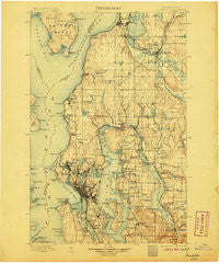
~ Seattle WA topo map, 1:125000 scale, 30 X 30 Minute, Historical, 1897, updated 1906
Seattle, Washington, USGS topographic map dated 1897.
Includes geographic coordinates (latitude and longitude). This topographic map is suitable for hiking, camping, and exploring, or framing it as a wall map.
Printed on-demand using high resolution imagery, on heavy weight and acid free paper, or alternatively on a variety of synthetic materials.
Topos available on paper, Waterproof, Poly, or Tyvek. Usually shipping rolled, unless combined with other folded maps in one order.
- Product Number: USGS-5411324
- Free digital map download (high-resolution, GeoPDF): Seattle, Washington (file size: 10 MB)
- Map Size: please refer to the dimensions of the GeoPDF map above
- Weight (paper map): ca. 55 grams
- Map Type: POD USGS Topographic Map
- Map Series: HTMC
- Map Verison: Historical
- Cell ID: 66651
- Scan ID: 243635
- Imprint Year: 1906
- Survey Year: 1895
- Datum: Unstated
- Map Projection: Unstated
- Map published by United States Geological Survey
- Map Language: English
- Scanner Resolution: 600 dpi
- Map Cell Name: Snohomish
- Grid size: 30 X 30 Minute
- Date on map: 1897
- Map Scale: 1:125000
- Geographical region: Washington, United States
Neighboring Maps:
All neighboring USGS topo maps are available for sale online at a variety of scales.
Spatial coverage:
Topo map Seattle, Washington, covers the geographical area associated the following places:
- Country Manor Mobile Home Park - Shady Lawn Mobile Home Park - Queen Anne - Morningside - Canyon Mobile Park - Airport Inn Mobile Home Park - Sunlight Beach - Firloch - Mercer Heights - Phinney Ridge - Penny Lynn Mobile Home Park - Frontier Manor Mobile Home Park - Candlewood Estates Mobile Home Park - Wallingford - Arroyo Heights - Yeomalt - Richmond Highlands - Alki - Sarvis Mobile Estates - Northwest Mobile Home Park - Halo Mobile Home Park - Overlake - Kenwood - Cathcart - Roosevelt - York - Hazelwood - Bothell - Royalwood Mobile Home Estates - Avondale Mobile Home Park - Snyders Corner - Jamison Corner - Sahalee - Coal Creek - Pinehurst - Beaux Arts Village - Kirkland - Midvale Corner - Clyde - Willows - Mercer Island Town - Royal Coachman Mobile Home Park - Pontiac - Rees Corner - Ballard - Mill Creek - Mukilteo - Columbia Beach - Woodcrest Estates Mobile Home Park - North Beach - Foy - Trailer Lane Mobile Park - Sherwood Village Mobile Home Park - Adams - Lucerne - Ravenna - Woodway - Pines - Carlton Park - Arbor Heights - Snohomish Mobile Home Park - Fryelands - Osborn Corner - Woodridge - Halcyon Mobile Home Park - Atlasta Mobile Park - Beardens Mobile Home Park - Newcastle - Haller Lake - Broadway - Somerset - Silver Firs - J and L Mobile Home Park - Seattle Hill - Riverside Mobile Estates - Delridge - Broadmoor - Capitol Hill - University Village - West Lake Stevens - Seward Park - Beaumont - Lakewood - White Center - Ashwood - Freeway Place Mobile Home Park - Hollywood Hill - Edgewater (historical) - The Highlands - Briarcliff - Northrup - Twin Creek Mobile Home Park - Kingston - Midlakes - Juanita - Inglewood - Maple Leaf - Sand Point - Day City (historical) - Parkwood
- Map Area ID: AREA4847.5-122.5-122
- Northwest corner Lat/Long code: USGSNW48-122.5
- Northeast corner Lat/Long code: USGSNE48-122
- Southwest corner Lat/Long code: USGSSW47.5-122.5
- Southeast corner Lat/Long code: USGSSE47.5-122
- Northern map edge Latitude: 48
- Southern map edge Latitude: 47.5
- Western map edge Longitude: -122.5
- Eastern map edge Longitude: -122


